12/3/2018
Topic:
Rockhouse report
tommy750
|
Nice TR Buford. Have only spent one night at the Cottonwoods and nearly froze. Looks like a fun trip. |
12/3/2018
Topic:
The Potrero Three Day BP
tommy750
|
ziphius wrote:
Nice trip Tommy / Daren. The bird is a Dark-eyed Junco and yes, the black-n-red insect is velvet ant. Very painful sting! I wandered over in that mine direction a couple of times. Lots of ranching artifacts for sure.
Thanks, Ziphius! Tom |
12/3/2018
Topic:
The Potrero Three Day BP
tommy750
|
Britain wrote:
tommy750 wrote:
Britain wrote:
Have that on my radar. They actually have parking now just south of the runway next to the Troutman Mountain. Looks like a nice pack.
Not sure whether that lot allows more than day parking. Only time I was ever over there, the gate that led out to the lot was closed.
Well, the equestrian parking would work. On another note, it's been reported that someone has been cutting off valve stems out there. A few reported being stranded.
That's not very nice. That would definitely suck coming back to that. |
1/9/2019
Topic:
Pinto Canyon
tommy750
|
Nice trip report and pics. Glad you made it out. Looks like you found everything as well. |
1/22/2019
Topic:
Bighorn-Nolina Canyon Loop
tommy750
|
So, did your wife like it?? Mine is happy to do the day hike/car camp thing but can't convince her (yet?) for an overnight backpack outing. Nice trip report. |
1/28/2019
Topic:
Bighorn-Nolina Canyon Loop
tommy750
|
Was out last year above Pinyon Wash about two miles east of Blue Spring and found a cache of four sheep remains, one still fairly pungent. Definitely a favorite area for the kitties. |
1/31/2019
Topic:
The "Original" LA Rams
tommy750
|
Found this interesting article about the local team playing in Sunday's Super Bowl and though you might enjoy it:
https://www.latimes.com/science/sciencenow/la-sci-sn-ram-facts-super-bowl-20190131-story.html |
2/6/2019
Topic:
Can you see Goat Canyon Trestle from McCain?
tommy750
|
Here's the places you can see Goat Canyon Trestle from McCain Valley:
 Goat from McCain by tomteske, on Flickr Goat from McCain by tomteske, on Flickr
Possibly could head to Redondo Flat or that little patch of white just to the SE of the Carrizo Overlook. The trestle is just too low to be seen from most of McCain Valley. |
2/13/2019
Topic:
Whale Peak Via Pictograph Trail
tommy750
|
Nice trip. Looks like the metal sign is holding up better than the old wood one. You ever try the Jerry Schad Whale Peak loop from Blair? Also kinda like starting in Pinyon Wash: https://caltopo.com/m/HTBN |
2/28/2019
Topic:
Canebrake Canyon Access
tommy750
|
Canebrake Valley and Inner Pasture (except for the small old Crawford ranch private inholding plugging the Canebrake Canyon mouth) are ABDSP and BLM (Sawtooth Mountains) Wilderness. They are NOT private. Usually no motorized vehicles are allowed in BLM Wilderness lands but not sure about whether driving on Canebrake dirt roads after passing through the private inholding with permission is allowed. BLM El Centro would know. Of course Border Patrol can do what they want. |
3/3/2019
Topic:
Desert snow
tommy750
|
Like your Seco de Diablo lake pic, Buford. Wife and I were heading up the arroyo a couple weekends ago and encountered three trucks covered in mud coming down. Hmmm. Mud puddles or the seep, right?? Nope.
 Just Gun It Right by tomteske, on Flickr Just Gun It Right by tomteske, on Flickr |
3/3/2019
Topic:
Old Maps
tommy750
|
Nice map. Blake's report on the Colorado Desert is here starting on page 228: https://books.google.com/books?id=Y92k3TEmYOkC&printsec=frontcover&source=gbs_ge_summary_r&cad=0#v=twopage&q=colorado%20desert&f=false |
3/18/2019
Topic:
Nolina Peak and a cougar
tommy750
|
Great trail cam clips, Tekewin. You can see a little brown line just to the right of your route starting point. That's where I found a cache of several sheep remains a while back. Your kitty is getting around. Need to start parking my old trail cam out in the boonies again! |
4/21/2019
Topic:
Martinez Peak and Little Pinyon Flat
tommy750
|
Looks like a nice trip. Cactus Spring dry? Here's an interesting BLM study of water sources in the Santa Rosas from a while back if you haven't already seen it:
http://www.cvmshcp.org/pdf%20files/Water%20Sources-SRSJNM%20FINAL%20REPORT-UCR.pdf |
4/21/2019
Topic:
Martinez Peak and Little Pinyon Flat
tommy750
|
dsefcik wrote:
rockhopper wrote:
The main entrance to Toro peak off the Hwy 74 was locked. :-o That is interesting....hummm...
Still closed due to winter storms: https://www.fs.usda.gov/recarea/sbnf/recarea/?recid=81714 |
4/21/2019
Topic:
Martinez Peak and Little Pinyon Flat
tommy750
|
rockhopper wrote:
Auga Alta spring update: We passed 3 fellow hikers that said they were out at Agua Alta and cleaned out the pipe into the spring and the water was flowing real good. I thanked them very much!
That's good to hear. Have only been there once about three years ago. Here's the spring before Daren put his back into it...
 Agua Alta Spring by tomteske, on Flickr Agua Alta Spring by tomteske, on Flickr |
4/22/2019
Topic:
Martinez Peak and Little Pinyon Flat
tommy750
|
rockhopper wrote:
tommy750 wrote:
dsefcik wrote:
rockhopper wrote:
The main entrance to Toro peak off the Hwy 74 was locked. :-o That is interesting....hummm...
Still closed due to winter storms: https://www.fs.usda.gov/recarea/sbnf/recarea/?recid=81714[/quote]
Have you seen the new gate? It is truly Massive and closer to the Hwy than the old one. The old gate has never been closed in close to 40 years I have been going up there even in the Winter. We thought it was closed due to the Coachella concerts. Thanks for the link. You always chime in with great info. Thanks!
This site has indicated the road was closed multiple times in the past few years. But, I've never actually drove out there and checked... |
4/29/2019
Topic:
Hike Suggestions?
tommy750
|
Isn't the legit way up Red Top via McCain Valley and Pepperwood Canyon??  |
5/30/2019
Topic:
Pinyon Wash - Memorial Day Weekend
tommy750
|
Sounds like a nice weekend out. Know it gets windy out there, but that Nolina guzzler looks like it's built F5/Category 5 tough!
edited by tommy750 on 5/30/2019 |
6/13/2019
Topic:
Descanso District
tommy750
|
Showed up to ride bikes on Saturday but missed out on all the exploring and the San Diego 100 race that passed a few feet from Daren's campsite on Friday night and made him miss a few winks of beauty sleep. Apparently he's run that race a few time. Winning time was 16:49:13 which is about what it take me to climb El Cajon once.
Somewhere near Morris Ranch Road
 Fat Bikes by tomteske, on Flickr Fat Bikes by tomteske, on Flickr
Couple lizards from the week before when my wife and I walked that stretch of the PCT. Lots of flowers along the trail but summer is coming...
 Horned Toad by tomteske, on Flickr Horned Toad by tomteske, on Flickr
 Lizard by tomteske, on Flickr Lizard by tomteske, on Flickr |
6/13/2019
Topic:
Anyone still here?
tommy750
|
Nice pics Buford. Really like your spiny lizard pic. |
6/13/2019
Topic:
Carrizo Creek
tommy750
|
Tamarisk already coming back?? Wow. Upper Carrizo Creek at I-8 is a complete mess and Google Earth seems to indicate the Carrizo Gorge eradication has ground to a halt. Maybe another couple wind energy projects to fund the long term maintenance? Just kidding. Or, maybe an "Adopt a Tree to Kill Over And Over" might catch on... |
7/17/2019
Topic:
Bighorn-Nolina Canyon Loop
tommy750
|
Here's the deer carcass I saw in Nolina downstream from the guzzler. Not sure if this is the same one you saw, Daren.
 IMG_1714 by tomteske, on Flickr IMG_1714 by tomteske, on Flickr |
8/5/2019
Topic:
The Killer at Christmas Circle
tommy750
|
Nice pics Ziphius. Your pics would fit right in on reddit.com/r/natureismetal |
9/15/2019
Topic:
Salton Sea to Cuyamaca Lake-Best Route?
tommy750
|
Roughly following San Felipe Creek/Old Kane Springs Rd to Fish Creek to Sandstone Canyon to Storm or Cottonwood or Oriflame Canyon would shave off 6-10 miles. Looks like a nice trek whatever route you chose. |
9/29/2019
Topic:
Tierra Blanca High Point
tommy750
|
Nice trip Tekewin. Was out in the Tierra Blancas today hiking just to the west of Canebrake Canyon. Walked by 39 roasting pits. Should have tried for one more Did come across this poor guy. Still had a strong odor:
 Sheep6 by tomteske, on Flickr Sheep6 by tomteske, on Flickr
 Sheep2 by tomteske, on Flickr Sheep2 by tomteske, on Flickr
 Sheep3 by tomteske, on Flickr Sheep3 by tomteske, on Flickr |
9/29/2019
Topic:
Pinyon Ridge
tommy750
|
Did the guzzler have much water? Nice pics, Daren. "...in the climate change year 2015." Nice. |
9/30/2019
Topic:
Tierra Blanca High Point
tommy750
|
No pool expert but aren't you supposed to keep hydrochloric acid and chlorine way the heck apart?? Chlorine gas is still unhealthy, right?
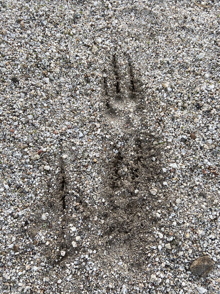
No kitty prints but it rained pretty hard earlier in the week. There were a lot of fresh sheep prints crossing the canyon further down.
Tekewin, how high up were you when you saw the water. Nice to see that out there. |
10/20/2019
Topic:
Earthquake & Mason Valley Days
tommy750
|
Looks like a great set of hikes, Daren. Glad you could get out there. |
10/20/2019
Topic:
Earthquake & Mason Valley Days
tommy750
|
Britain wrote:
Love the film photos. Didn't you guys do oriflame up and over to cottonwood a ways back?
Gary and I did the Oriflame Cottonwood trip. Wish we would have had more time out in Cottonwood especially since there was lots of water.
http://www.anzaborrego.net/anzaborrego/forum/topic1279-oriflame-to-cottonwood-canyon--day-bp.aspx |
10/28/2019
Topic:
Sheep outside Anza Borrego (photo heavy)
tommy750
|
Looks like a nice trip. Assuming Utah Arizona? Great pics. Thanks. |
10/28/2019
Topic:
CalTopo is stepping up their game
tommy750
|
Downloaded the caltopo app recently. Since it's beta, you need to download TestFlight from the App Store (I have an iPhone) and then get a link from caltopo to their app. Used it yesterday on a bike ride and it worked well enough. You can access your entire map collection and then hit start to begin tracking. Looked at the new motor vehicle MVUM layer Daren mentioned but didn't seen to add much useful and a lot of the roads are labelled "unspecified" or "limited access." ABDSP is pretty much completely blacked out of this layer. The app doesn't have a GE satellite layer but if you pull up one of your saved maps it will give you what looks to be GE if it's your saved base layer on your map. Props to Daren for introducing me to caltopo. It's a great tool to have.
Here's a screen grab from a Grand Canyon hike last year:
 app3 by tomteske, on Flickr app3 by tomteske, on Flickr
A list of some of my saved maps easily accessed with the app:
 app2 by tomteske, on Flickr app2 by tomteske, on Flickr
Starting your track:
 app1 by tomteske, on Flickr app1 by tomteske, on Flickr |
10/29/2019
Topic:
Sheep outside Anza Borrego (photo heavy)
tommy750
|
Buford wrote:
tommy750 wrote:
Looks like a nice trip. Assuming Utah Arizona? Great pics. Thanks.
Correct, Arizona and Utah. Nothing too far off the beaten path.
Some national parks, some blm land, some GSE, some NSF lands.
Are some of the pics from part of The Wave?? |
10/31/2019
Topic:
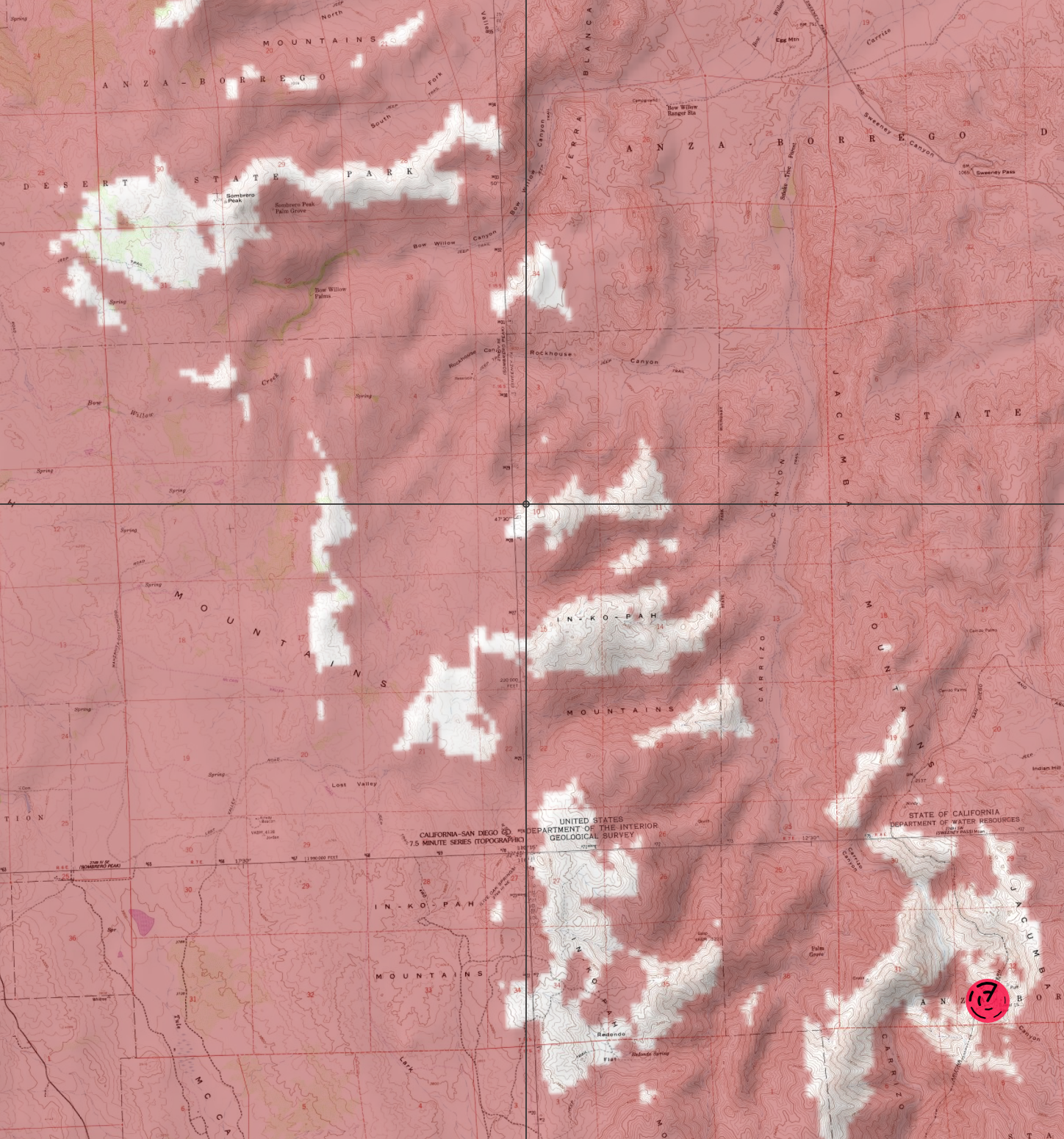
Rockhouse Canyon / Rockhouse Valley
tommy750
|
dsefcik wrote:
Buford wrote:
Most SUVs and trucks should be able to get to the Butler/Rockhouse junction. The final 3 miles to the end of Rockhouse Truck Trail can be a mess. It depends on how bad the monsoons were, how armored your vehicle is, or how tolerant you are of body damage.
Very tolerant....this was from back in 2013, just didn't see that boulder...

Excuse me but aren’t you the guy blowing me sh*t for the rocker panel microscratch on the Tundra you bought from me that I got while jammed up in Hueso wash?? |
11/11/2019
Topic:
Best route for hike from Laguna to desert floor?
tommy750
|
Rocko1 wrote:
Will be getting some time off soon and I'd like to try this route https://caltopo.com/m/S0R8 as a day hike. The majority of it appears to be on BLM. Anyone see any issues with this and the possibility of it crossing private land?
Can't comment on the Cuyamaca route but your Mason Valley truck trail and Cottonwood routes look fine. You could take a bit of the old Lassater Hay road back to your vehicle by following a ridge with a faint road just as the MVTT turns toward the NW. Pull up the 1915-1945 historic topo layer to see it. |
11/11/2019
Topic:
Brand New Rock Art Book November 2019
tommy750
|
Another great book, Don. The webmaster needs to update your ad on this site to Volume 2 since you sold out Volume 1. |
11/14/2019
Topic:
The ABF 2020 ABDSP Photo Contest
tommy750
|
Buford wrote:
Here are last years winners.
https://flic.kr/s/aHsmzXErx4
My favorites are the smoke tree and the rattler with the mosquito.
Most are really good. Others 
Agree, the snake/bug pic is nice. Looks like everyone else just discovered HDR, brush tool and the vibrance/saturation sliders. Don't understand the second place for a pic of illegal scraped off tent sites at Wind Caves. Maybe I just need a drink... |
11/20/2019
Topic:
Sunrise Hwy to Granite Mountain
tommy750
|
Nice trip, Rocko. The 2002 Pines fire cleared out all the brush on the eastern slopes of the Lagunas but is it ever back with a vengeance! Daren and I were out exploring off trail in that same band of chaparral a couple weekends ago and gave up after a couple miles of nasty bushwhacking. Your really healthy area on Granite below 4000ft doesn't show any recent fire damage so maybe that's why it looked so good. |
12/1/2019
Topic:
Death Valley 9 Days Trip Report
tommy750
|
Looks like a great trip Daren. Nice pics. I like those new K02s. |
12/6/2019
Topic:
Lower Carrizo Creek
tommy750
|
Nice trip Britain. Was out there five years ago (how time flies) in the midst of the tamarisk abatement ( http://www.anzaborrego.net/AnzaBorrego/Forum/topic948-carrizo-badlands.aspx ). Looks like Leckie gained a few rocks and a soda can since I was there. So how much water did you see in Carrizo at "flood stage?" |
12/6/2019
Topic:
Death Valley 9 Days Trip Report
tommy750
|
deborah wrote:
Nice pictures on your other site too. That's a serious vehicle by the Trona Pinnacles. Do you happen to know what it was for? Looks like someone was on a serious mission.
That's one of those expedition vehicles that can go anywhere as long as it's open terrain with a city block to turn around and your mechanic and accountant are on speed dial. Mercedes' Unimog and MAN are popular platforms. Big in Europe. Can probably pick up a nice used one for under $500K. |
12/8/2019
Topic:
Jacumba Mountains
tommy750
|
Haven't been able to get out much lately but rain or shine decided to head out yesterday for hike in the Jacumba Mountains. Rained intermittently all day but never enough to put on rain gear.
 Rain by tomteske, on Flickr Rain by tomteske, on Flickr
One of many granitic domes in the area.
 Granitic Dome by tomteske, on Flickr Granitic Dome by tomteske, on Flickr
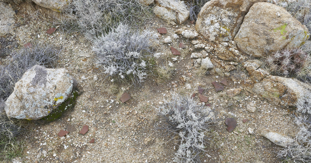
Nice drilled rim sherd.
 Drilled Rim Sherd by tomteske, on Flickr Drilled Rim Sherd by tomteske, on Flickr
Piece of burnt bone presumably from a burial site.
 Burnt Bone by tomteske, on Flickr Burnt Bone by tomteske, on Flickr
View toward Dos Cabezas
 Toward Dos Cabezas by tomteske, on Flickr Toward Dos Cabezas by tomteske, on Flickr
Tinaja
 Tinaja by tomteske, on Flickr Tinaja by tomteske, on Flickr
No obvious migrant trails but someone left their cobija.
 Cobija by tomteske, on Flickr Cobija by tomteske, on Flickr
Nice pot drop.
 Pot Drop by tomteske, on Flickr Pot Drop by tomteske, on Flickr
 Pot Drop 2 by tomteske, on Flickr Pot Drop 2 by tomteske, on Flickr
 Hilltop by tomteske, on Flickr Hilltop by tomteske, on Flickr
 Agave by tomteske, on Flickr Agave by tomteske, on Flickr
View looking north with a peek of sunlight.
 Looking North by tomteske, on Flickr Looking North by tomteske, on Flickr
Large cairn in the middle of nowhere.
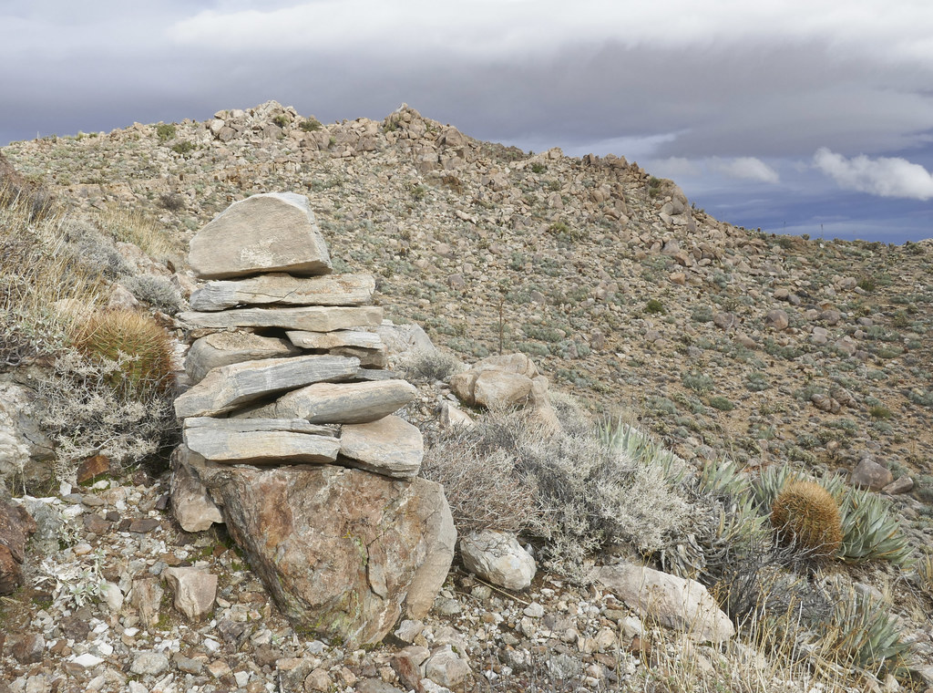 Large Cairn by tomteske, on Flickr Large Cairn by tomteske, on Flickr
Stumbled on this practice bomb a long way away from the nearest bombing range. This is the tail fins section but not a good view. The rest of the bomb was a few yards away. Interesting find on Pearl Harbor Day.
 Tail Fins by tomteske, on Flickr Tail Fins by tomteske, on Flickr
 Practice Bomb by tomteske, on Flickr Practice Bomb by tomteske, on Flickr
Heading home. The truck is parked at the bump just past Palm Canyon Wash. About ten miles and 2.5K g/l and another nice day in the desert. Enjoy! Tom
 Heading Home by tomteske, on Flickr Heading Home by tomteske, on Flickr |
12/8/2019
Topic:
Jacumba Mountains
tommy750
|
Britain wrote:
Awesome! If that's the hill up the blocked off road north of Montero Palms been up there a while back.. Crossed over to Puff and down.if not cool hike!
Was south of that road and headed more toward Moan but similar area. Really like it up there.
Ziphius, don't mind the rain either, just don't like wind!
Daren, you would have like it since there was a lot of ascending/descending steep rocky slidy stuff
edited by tommy750 on 12/8/2019 |
12/12/2019
Topic:
Granite Mountain West Approach
tommy750
|
Nice TR. Never been up Granite. BTW, who is Norman Glover?? |
12/15/2019
Topic:
Jacumba Mountains
tommy750
|
Rocko1 wrote:
Very nice. Did you get up there north of Palm Canyon Wash?
Yes, I kinda went straight up the ridge running NS between Palm Canyon and the dirt road to the North |
12/17/2019
Topic:
Mortero Palms to Goat Canyon Trestle, then North
tommy750
|
Welcome back, Anutami! Haven't seen a post from you in literally years?? Great trip report. |
12/17/2019
Topic:
Kitchen Creek Fall Colors
tommy750
|
Nice pics Deborah. Lots of pretty fall colors. |
12/20/2019
Topic:
Inner Pasture Suggestions?
tommy750
|
If you're day hiking or overnighting, I would be much more concerned about bumping into cholla than immigrants. Agree with Buford most of the traffic into Canebrake, Potrero and Storm is originating from Pepperwood and exiting out MM41 or climbing over the Canebrake/Potrero saddle and exiting Potrero/Storm. Not much reason to transit the rest of IP. A nice loop to IP would be parking at Agua Caliente, going up Squaw and returning Moonlight. Did that once as an overnight with Daren in 90+ temps with 7-8L on my back and swore I'd never do Squaw again. But a day hike would be nice. Always have wanted to go back and explore the plateau above Squaw. Have fun. |
12/24/2019
Topic:
Jojoba Wash with new All Terrain Bobcat truck camp
tommy750
|
Bob, envious of your roof top tent for so long, this year I finally decided to upgrade. And now, you've moved on. ¯\_(ツ)_/¯ Congrats on your new setup! |
12/26/2019
Topic:
Jojoba Wash with new All Terrain Bobcat truck camp
tommy750
|
surfponto wrote:
Thanks Tom,
Still love the roof top tent but you are right, the popup camper is a whole different level of glamping
What kind of tent did you get?
Ended up getting a Tepui Kukenan 3. Was planning on getting a clam shell design but ended up getting something that mounts on a bed rack and not on top of the vehicle. Have only had time for a couple overnights but so far I like it and haven't fallen going down the ladder. Yet. The important thing is the wife signed off on it cuz no bugs and snakes etc etc etc. |
12/29/2019
Topic:
Rain and more sheep
tommy750
|
Nice pics Buford! Looks like the sheep were in your back yard. What lens you using? |
12/29/2019
Topic:
Indian Signs Along Carrizo Wash
tommy750
|
Someone emailed me this March 1974 Desert Magazine article a while back and I ended up reprising the same route yesterday except the author arrived from the north on EC 085 and I from the south. The author basically drove down from 78 and poked around Carrizo wash south of the Fish Creek Mts a bit, pretty much my trip 45 years later.
 Indian Signs by tomteske, on Flickr Indian Signs by tomteske, on Flickr
EC 085 was recently graded and moist from the rains so very easy to drive. Also new signage indicates it's on the Juan Bautista de Anza National Historic Trail.
 EC 085 by tomteske, on Flickr EC 085 by tomteske, on Flickr
The "iron mountains" seem larger than my last trip out here.
 Iron Mountains by tomteske, on Flickr Iron Mountains by tomteske, on Flickr
Unsurprisingly, there was way more traffic than usual.
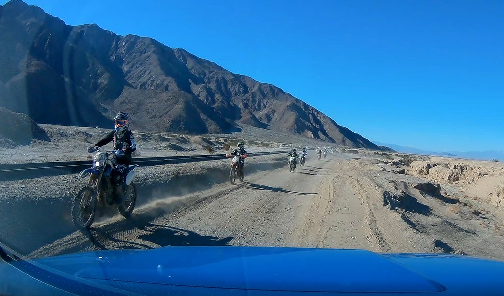 Bikers by tomteske, on Flickr Bikers by tomteske, on Flickr
 Carrizo Wash by tomteske, on Flickr Carrizo Wash by tomteske, on Flickr
Took the fat ebike along and rode up Carrizo Wash doing some hiking as well.
 Tundra and Fat Bike by tomteske, on Flickr Tundra and Fat Bike by tomteske, on Flickr
Hiked over to an area at the base of the Fish Creek Mts where the latest GE satellite imagery indicated a new spot had appeared.
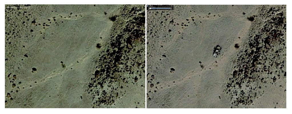 Change by tomteske, on Flickr Change by tomteske, on Flickr
Doesn't look stripped so maybe insurance fraud??
 Burnt1 by tomteske, on Flickr Burnt1 by tomteske, on Flickr
 Burnt2 by tomteske, on Flickr Burnt2 by tomteske, on Flickr
 Melted by tomteske, on Flickr Melted by tomteske, on Flickr
 Moto Metal by tomteske, on Flickr Moto Metal by tomteske, on Flickr
 Burnt3 by tomteske, on Flickr Burnt3 by tomteske, on Flickr
On a nearby rise, a rock circle pictured in the Desert Magazine article and what it looks like 45 years later.
 Rock Circle by tomteske, on Flickr Rock Circle by tomteske, on Flickr
In an adjacent rocky cove, a site with milling previously described as strewn with sherds (I found one only). A slick with a central mortero and two hand stones looks pretty much unchanged.
 Mortero Slick by tomteske, on Flickr Mortero Slick by tomteske, on Flickr
Did find a couple petroglyphs not noted in the article and maybe the most inconsequential rock art find of the year
 Two Petros by tomteske, on Flickr Two Petros by tomteske, on Flickr
Heavily enhanced versions. Clothes Hanger Man and a super basic Bighorn (better yet, Pronghorn)??
 Petro1 by tomteske, on Flickr Petro1 by tomteske, on Flickr
 Petro2 by tomteske, on Flickr Petro2 by tomteske, on Flickr
On a ridge above the site were a half dozen small rock walled shelters. Doubt they were old and you'd have to be pretty small to fit inside one.
 Rock Wall by tomteske, on Flickr Rock Wall by tomteske, on Flickr
Followed a section of unscathed native trail hugging the hillside above the zillion vehicle tracks mere feet below.
 Trail by tomteske, on Flickr Trail by tomteske, on Flickr
Skull of ewe.
 Ewe Skull by tomteske, on Flickr Ewe Skull by tomteske, on Flickr
Heading back, encountered the unluckiest of drivers getting cited by BLM law enforcement. Forgot to signal maybe?? He looked utterly dejected.
 Busted by tomteske, on Flickr Busted by tomteske, on Flickr
Nothing fancy but another great time out in the desert. Enjoy! Tom |
12/30/2019
Topic:
Snow and more sheep
tommy750
|
Buford, I think your posts are giving people the impression BHS aren't endangered anymore since they're everywhere! |
12/30/2019
Topic:
Indian Signs Along Carrizo Wash
tommy750
|
surfponto wrote:
E-Bike? Hmm now you have me thinking 
Fat biking with a little boost is really nice out in the sand and rocks. Haven't used it as much as I'd liked but sure is fun. Did a 21 mile ride out in Canyon Sin Nombre and Vallecito a while back and was a decent workout but much easier and more fun with a little help. This trip was probably only about five miles on the bike and a few miles hiking. Would definitely look into it! |
12/30/2019
Topic:
Indian Signs Along Carrizo Wash
tommy750
|
Rocko1 wrote:
tommy750 wrote:
surfponto wrote:
E-Bike? Hmm now you have me thinking
Fat biking with a little boost is really nice out in the sand and rocks. Haven't used it as much as I'd liked but sure is fun. Did a 21 mile ride out in Canyon Sin Nombre and Vallecito a while back and was a decent workout but much easier and more fun with a little help. This trip was probably only about five miles on the bike and a few miles hiking. Would definitely look into it!
So it does ok in softer sand?
I think it works great in softer sand. Haven't taken it to Superstition or Glamis but that's not really my thing. Any sandy road shouldn't pose a problem. With the tires at about 5lbs pressure it's a smooth stable ride. |
12/30/2019
Topic:
Indian Signs Along Carrizo Wash
tommy750
|
Deborah/surfponto/Buford: There's definitely interesting stories and trips in this area in Desert Magazine that would be fun to reprise. The Hank Brandt lost mine saga is kinda interesting and someone has previously alluded to it a few years back in the comments (now blurred out by Photobucket's subscription for third party hosting demands): http://www.anzaborrego.net/anzaborrego/Forum/topic721-west-mesa.aspx. Does anyone know if Desert Magazine is still being hosted somewhere online? Daren posted a link in 2011 but it doesn't work now. I happened to buy a CD years ago with all the issues for $5. |
1/3/2020
Topic:
Indian Signs Along Carrizo Wash
tommy750
|
Britain wrote:
Did you see this post?
http://www.treasurenet.com/forums/california/80018-hanks-mine-found.html
Here is Magazine
https://archive.org/details/Desert-Magazine-1966-07/page/n7 You can download PDF on lower right side of that page.
Yeah, I've seen both of those article and the original Desert Magazine story from 1964. Have played around on GE a bit trying to verify anything about the their accounts. The 1966 authors appear to have "discovered" Hank's Lost Mine, a manganese not gold mine in SW Fish Creek Mountains (in the CIA) and described in the publications on mineral resources of the Fish Creek Mts here: https://pubs.usgs.gov/bul/1711c/report.pdf There is a trail ascending to the mine from Carrizo Wash easily visible on GE but it's only .7 miles to Hanks mine with multiple other mines nearby including the Bonanza Queen copper mine, It's not the 2+ mile hike the authors indicate. Not sure how hobbled Hank Brandt would have been able to dig a 30 ft shaft by himself, either.
Regarding the other author, I've been to the flat in his image three (not by his route) but didn't go around the corner to investigate the spot he shows in his fourth pic. It doesn't look like mine tailing on GE however. It's definitely not in the CIA and nowhere near Hank' Lost manganese Mine. Did notice a mention of a trail from the Fish Creek Mts to Split Mt and was actually already planning to try and find that tomorrow.
Great stories and a lot of fun trying to parse their meaning!
Sorry, it's Rocko1 I'm quoting above.
edited by tommy750 on 1/3/2020 |
1/5/2020
Topic:
Weekend trip
tommy750
|
Again, great pics! |
1/9/2020
Topic:
Plane Wrecks
tommy750
|
Britain wrote:
My dad used to fly a version of that plane. Vid of him putzing about over San Diego Bay.
https://youtu.be/B5HbHBeOUFA
edited by Britain on 12/28/2019
Nice clip! |
1/28/2020
Topic:
Salt Creek/Cottonwood Canyon
tommy750
|
Glad to hear Salt Creek is flowing well. Went down that road into Cottonwood a few years ago and didn't enjoy that washed out segment either! Nice TR. Cottonwood is definitely worth a 2-3 day trip. |
2/2/2020
Topic:
Gert Wash
tommy750
|
I walked on that trail ( http://www.anzaborrego.net/anzaborrego/Forum/topic1344-carrizo-creek-bm-lost-and-south-mesa.aspx ) and it certainly could be a native trail. Found a large cairn and rock circle on it and looks like it may continue NW on the other side of the wash through South Mesa. Could also have been an access trail to the rock square which appears to be along a chain of 7-8 squares on a NS line. Assuming the squares were some sort guidance for bombing runs but who knows. |
2/2/2020
Topic:
June Wash and Hapaha Flat saddle
tommy750
|
Nice trip report, Brian. Visiting that guzzler and maybe an eastern ascent of Whale Pk is on my to do list. Thanks. |
2/3/2020
Topic:
Gert Wash
tommy750
|
Rocko1 wrote:
Nice find. I love looking for well worn trails that are not from modern use. This one on the south east side of Chariot has intrigued me.

edited by Rocko1 on 2/3/2020
That's the Lassater Hay Road. Also spotted that on GE and went out there a while back and hiked the entire section. Reportedly Lassater would take the wheels off the fully loaded wagons and slide them down the steep slope till they got to the bottom of Oriflame. Then the wheels were replaced and the wagons continued to the Vallecito Stage station. There's historical accounts indicating this one section was really sketchy even to the 19th Century crowd.
 Lassater Hay Road by tomteske, on Flickr Lassater Hay Road by tomteske, on Flickr |
2/3/2020
Topic:
Gert Wash
tommy750
|
Rocko1 wrote:
edited by Rocko1 on 2/3/2020
Thanks Tommy. I thought it was close to the hay road but what threw me was how well worn and narrow the path is now in that section. I assume from big horn sheep use maybe?
I think the road is much easier to see on GE than on foot. To the left of the drainage and heading to the west, you're right, it's mainly a game trail. The section from that ridge to the truck trail is really difficult to find since fire breaks and newer roads/trails have popped up but it's still visible on GE images from the 1990s and comparing them to old topo maps. Was hoping to find some historical stuff along the route but didn't see anything. James Lassater was an interesting guy running the Vallecito Stage station and supplying it with hay from his Green Valley ranch in the Lagunas. Supposedly his stone house is somewhere in the Green Valley Campground but not sure if it's still there.
This is a view from the road toward where it crosses the drainage. There's a similar pic in a 1970's San Diego Union newspaper article about some guy who spent 30 years trying to find the hay road through Oriflame. He found this section but misidentified the steep descent placing it about a mile or so to the east.
 P1050816 by tomteske, on Flickr P1050816 by tomteske, on Flickr
This is the steep descent to the truck trail. You can see a faint white line in the center of the pic. Like I said, much easier to find on GE.
 P1050844 by tomteske, on Flickr P1050844 by tomteske, on Flickr
Sorry for ripping off your post, Britain! |
2/25/2020
Topic:
Whale Peak overnight
tommy750
|
Nice TR, Ziphius. That's pretty much the same route I remember taking on my first trip up Whale about 15 yrs ago. Was straight out of Schad's book but back then it started in the Blair parking lot, crossed over Foot and Walker to that dirt road. The rest was the same but after crossing Little Blair, you climbed the saddle on that ridge between Little Blair and Blair.
Probably the most serene moment I can recall hiking in the desert was walking through that little meadow between the ascending canyon and Smuggler while it snowed, everything dusted with white and utter silence. Nice memories. |
3/3/2020
Topic:
Martinez Mtn. Snow
tommy750
|
So this in on the internet: http://www.cvmshcp.org/pdf%20files/Water%20Sources-SRSJNM%20FINAL%20REPORT-UCR.pdf
Don't recall if anyone posted this here before but it has a pretty detailed description of water sources in the area including a couple other potential sources east of Horsethief. Have only been out to Agua Alta once in 2015 from Martinez and it looked pretty sketchy in November.
Looks like a nice trip. |
3/9/2020
Topic:
Granite Mountain Overnight
tommy750
|
Nice TR Rocko1. Daren and I were down the mountain from you in Canebrake on Saturday and I was complaining about the wind that night in June Wash---in front of the propane fire pit. Guess you had way more type 2 fun than we did Great pics especially your 4th and 5th ones.
I have a Zpacks Altaplex (discontinued) and really like it (especially the 1.5 lb weight) but it does get pretty noisy in the wind even with all ten guylines as taut as I can make them. |
3/10/2020
Topic:
Granite Mountain Overnight
tommy750
|
Rocko1 wrote:
tommy750 wrote:
Nice TR Rocko1. Daren and I were down the mountain from you in Canebrake on Saturday and I was complaining about the wind that night in June Wash---in front of the propane fire pit. Guess you had way more type 2 fun than we did Great pics especially your 4th and 5th ones.
I have a Zpacks Altaplex (discontinued) and really like it (especially the 1.5 lb weight) but it does get pretty noisy in the wind even with all ten guylines as taut as I can make them.
Nice. Things starting to bloom in June? I saw a couple of fires on the west slope of Whale and wondered if anyone here was out camping. I wish I had a gauge to tell the true wind speed.
They just re-released the Altaplex a month or so ago. Looks like a great tent. I had to put a sort of knot behind the Lineloc to stop it from slipping through the night. Do you significant pressure changes inside your tent during wind? It was enough to rock us back and fourth like mini-sonic booms.
Definitely starting to bloom in Canebrake. The altaplex is back! And different colors too. Thanks for the updated info. Not sure about the sonic boom sensation but mainly noisy flapping of the dyneema in the wind. Now, I always bring earplugs when doing an overnight. Good for the wind and your snoring hiking buddies. I bought a Kestrel weather station a while back and have used it on occasion while backpacking. Never bothered to set it up outside my pack for accurate temperature tracking and haven't used it as much as I'd hoped. Still a nice unit that syncs with your phone. |
3/17/2020
Topic:
Three Saturdays in Canebrake
tommy750
|
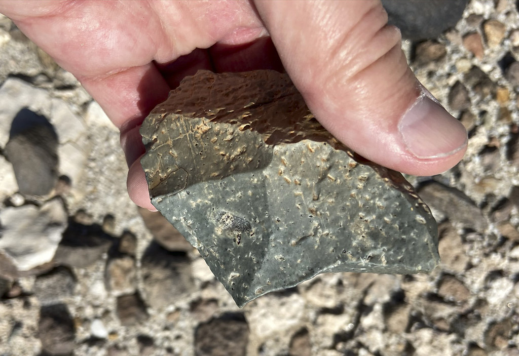
Haven't been in Canebrake Valley for a while but wasting time on GE one morning, I spotted what appeared to be a spring exploited by ranchers that I've never noticed before. That led to three Saturdays and about 45 miles wandering around, twice starting at North Fork Indian Valley and once accompanied with Daren from Mile Marker 41. Checked out an occupation site and found a few projectile points. Not sure if these broke during production or returned inside the prey after a successful hunt. Nice broken Cottonwood point:
 IMG_3047 by tomteske, on Flickr IMG_3047 by tomteske, on Flickr
Equally nice Desert Side Notch point. Supposedly if it has a basal notch it's a Sierra Side Notch:
 IMG_3058 by tomteske, on Flickr IMG_3058 by tomteske, on Flickr
Cremated bone:
 IMG_3045 by tomteske, on Flickr IMG_3045 by tomteske, on Flickr
Crawling out of a rock shelter was surprised to find this striped Desert Side Notch:
 IMG_3108 by tomteske, on Flickr IMG_3108 by tomteske, on Flickr
Further up valley came across these straps and ?harness. Immediately suspected it was from the parachute or ejection seat of the downed T-33 near Agua Caliente:
 IMG_3227 by tomteske, on Flickr IMG_3227 by tomteske, on Flickr
 IMG_3230 by tomteske, on Flickr IMG_3230 by tomteske, on Flickr
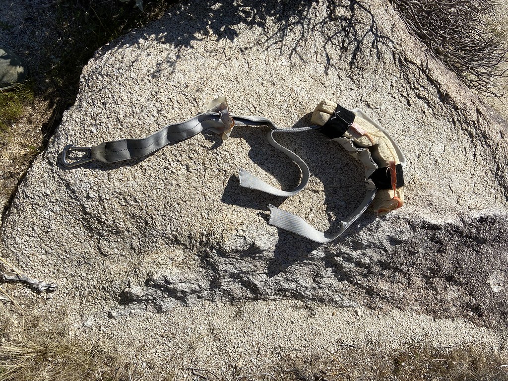 IMG_3236 by tomteske, on Flickr IMG_3236 by tomteske, on Flickr
French INOX carabiner:
 IMG_3238 by tomteske, on Flickr IMG_3238 by tomteske, on Flickr
But if you compare the straps cut from the T-33 ejection seat Daren found a while back ( the other one was recovered), the straps look quite different so who knows. You guys know what this is??
 Two Belts by tomteske, on Flickr Two Belts by tomteske, on Flickr
Daren showed me an old ranching camp which also was a native occupation site:
 IMG_3339 by tomteske, on Flickr IMG_3339 by tomteske, on Flickr
 IMG_3348 by tomteske, on Flickr IMG_3348 by tomteske, on Flickr
And this historical artifact:
 IMG_3341 by tomteske, on Flickr IMG_3341 by tomteske, on Flickr
Almost stepped on this guy:
 IMG_3196 by tomteske, on Flickr IMG_3196 by tomteske, on Flickr
Skid marks:
 IMG_3159 by tomteske, on Flickr IMG_3159 by tomteske, on Flickr
Beautiful scenery all around:
 IMG_3356 by tomteske, on Flickr IMG_3356 by tomteske, on Flickr
 IMG_3351 by tomteske, on Flickr IMG_3351 by tomteske, on Flickr
Daren checking out cattle bones:
 IMG_3371 by tomteske, on Flickr IMG_3371 by tomteske, on Flickr
Actually, I think the main reason Daren went was to recover this old school radiosonde Unfortunately, we didn't have time to swing by and collect it. Daren says you might get a nice tour of the local NOAA site if you drop off a vintage model.
 IMG_3276 by tomteske, on Flickr IMG_3276 by tomteske, on Flickr
Oh yeah, the spring! So, the now dry spring was an occupation site and then much later used for a cattle watering trough. A water trough was constructed on top of a boulder that contained multiple morteros and still has pottery next to it. A modern round trough was apparently added later. You can see piping heading up to a green spot above. Never seen anything like it:
 IMG_3250 by tomteske, on Flickr IMG_3250 by tomteske, on Flickr
Morteros inside the trough:
 IMG_3255 by tomteske, on Flickr IMG_3255 by tomteske, on Flickr
Lots of dried grass below the now dry spring:
 IMG_3269 by tomteske, on Flickr IMG_3269 by tomteske, on Flickr
Heading home. Enjoy! Tom
 IMG_3294 by tomteske, on Flickr IMG_3294 by tomteske, on Flickr
edited by tommy750 on 3/17/2020 |
3/17/2020
Topic:
Three Saturdays in Canebrake
tommy750
|
Rocko1 wrote:
Wow! Some fantastic finds. I would assume the spring would have some dampness/trickle with the weather we have had.
Would be nice to find at least seasonal flow. The vegetation and organic layer is so dense at this location I'm not sure a small amount of flow would be visible but who knows and maybe it's worth another visit. |
3/17/2020
Topic:
Three Saturdays in Canebrake
tommy750
|
rockhopper wrote:
Looks like you covered a lot area on foot of that vastly in under explored place in our county. 45 miles. Wow! Good eye on the arrow points. The fact that the points were not made of the preferred obsidian means that most likely Lake Cahuilla was full thus covering the locals preferred obsidian source. Good point on the ranchers / miners building atop of older habitations. I've noticed that too.
Really like that area since it's so desolate and peaceful. That's a good observation about the alternative materials when Obsidian Butte was under water. Don't know if the obsidian hydration techniques are accurate enough to determine if all the obsidian artifacts around here dated to periods when the butte was exposed or whether it's already been looked at. Did find one obsidian point but pretty beat up. |
3/17/2020
Topic:
Three Saturdays in Canebrake
tommy750
|
Scooter wrote:
Thank you for a great trip report. I have backpacker in over night from the North Fork of Indian Valley not to bad. Great area to explore
Definitely agree. Pepperwood Canyon is my favorite way in and of course there's that little 2000 ft bounce on your way out that's always a healthy pulse quickener |
3/18/2020
Topic:
Three Saturdays in Canebrake
tommy750
|
Brian wrote:
Seeing artifacts - even relatively recent ones like the ejection strap - always makes me think of the event that caused that object to be there and how it has been undisturbed and mostly unobserved since. It gives a sense of the scale of time. It's one of the things I love about the desert.
Definitely agree. Lots of backstories to ponder. |
3/24/2020
Topic:
Three Saturdays in Canebrake
tommy750
|
Here's a recent article on Obsidian Butte: http://www.swxrflab.net/obsbutte.htm Looks like it just formed 2500 years ago. Most of our local obsidian is from Obsidian Butte but smaller amounts are sourced from Coso Volcanic Field to the north and San Felipe to the south. Nice how the chemical signature can definitely identify the source. Obsidian Butte is listed by the USGS as a "high to very high" volcanic threat rank and the only one so designated in So Cal. |
4/8/2020
Topic:
GPS Collar Retrieval Near Rabbit
tommy750
|
The weekend prior to the park closure, Daren, Gary, Randy and I headed up a steep rocky ridge toward a tight grouping of gps points, the last data bursts from of a dying tracking collar. The unfortunate wearer was a ewe, presumably a victim of mountain lion predation and lying in peace somewhere on an east facing slope midway between Rabbit and Villager. The last pings were time stamped early 4/2019. With the collar battery lasting about five years, it was unclear when the ewe died or whether the collar was currently anywhere near the sheep remains. That night, Daren would return with collar in hand completing the successful recovery with little help from his hiking companions.
 IMG_20200328_140523_7 by tomteske, on Flickr IMG_20200328_140523_7 by tomteske, on Flickr
This all started when Daren emailed the group stating he was asked by a Fish and Game biologist to recover said collar ( apparently they're not cheap) and inviting us along for the adventure. Daren suggested the obvious route up the Villager ramp as an overnight. However, being the least experienced and least knowledgeable hiker in the group but apparently with the most free time, I suggested an an old native trail ascending sharply from the banks of Clark Lake to the Santa Rosa spine and ending on Rabbit. My route information was based on exactly two sentences extracted from an old BLM document and hours of rather imaginative trail spotting on GE. It would shave a couple miles off the standard route and looked much easier, at least from outer space. After successfully bamboozling the group on the "better" route, we all met under the NE shoulder of Coyote Mt and headed out.
Getting ready
 IMG_3533 by tomteske, on Flickr IMG_3533 by tomteske, on Flickr
Somewhere in the middle of Clark Lake, a vertical gas tank.
 IMG_3534 by tomteske, on Flickr IMG_3534 by tomteske, on Flickr
Also, somewhere in the middle of the the lake, BM Camp.
 IMG_3541 by tomteske, on Flickr IMG_3541 by tomteske, on Flickr
After crossing the lake bed, we made it to the start of the "obvious" trail on GE.
 IMG_3544 by tomteske, on Flickr IMG_3544 by tomteske, on Flickr
It truly was an old native trail and somewhat farther up, a nice petroglyph site.
 IMG_3551 by tomteske, on Flickr IMG_3551 by tomteske, on Flickr
 IMG_3548 by tomteske, on Flickr IMG_3548 by tomteske, on Flickr
 IMG_3555 by tomteske, on Flickr IMG_3555 by tomteske, on Flickr
 IMG_3563 by tomteske, on Flickr IMG_3563 by tomteske, on Flickr
Gary checking out trail cairns.
 IMG_3570 by tomteske, on Flickr IMG_3570 by tomteske, on Flickr
View from camp at the base of the Santa Rosa Mts.
 IMG_3577 by tomteske, on Flickr IMG_3577 by tomteske, on Flickr
The next morning, we cached our gear and started up the "trail" planning on day hiking to the top, finding the collar and returning to the vehicles. But to our dismay, there was no trail. None. Just a scramble up steep rocky terrain.
Nice piece of pottery before the ascent.
 IMG_3583 by tomteske, on Flickr IMG_3583 by tomteske, on Flickr
Halfway up the first 1300 ft slog, a nice land snail, the first one I've ever seen out in the desert.
 IMG_3585 by tomteske, on Flickr IMG_3585 by tomteske, on Flickr
Halfway up the second slog, I found this rotting Buck knife sheath. Little did I know but just minutes before it contained a pristine Buck knife, rescued by Daren who was by now far ahead of me (Gary and Randy had already had enough of my "route" and called it a day).
 IMG_3596 by tomteske, on Flickr IMG_3596 by tomteske, on Flickr
There actually was a trail ascending the ridge at some point as a pot drop along with multiple roasting pits, rubs and pottery sherds would attest. Just not anymore.
 IMG_3600 by tomteske, on Flickr IMG_3600 by tomteske, on Flickr
The view from a few rubs.
 IMG_3603 by tomteske, on Flickr IMG_3603 by tomteske, on Flickr
 IMG_3610 by tomteske, on Flickr IMG_3610 by tomteske, on Flickr
The last slog to the top.
 IMG_3611 by tomteske, on Flickr IMG_3611 by tomteske, on Flickr
Finally on top, the view toward Rabbit and the collar, somewhere between the far green patch and faint white vertical line on the east ridge heading up Rabbit. By now, Daren had recovered the collar and was heading back having wisely chosen not to wait for his "team."
 IMG_3615 by tomteske, on Flickr IMG_3615 by tomteske, on Flickr
Here's Daren's pics of the sheep and collar.
 IMG_20200328_140545_8 by tomteske, on Flickr IMG_20200328_140545_8 by tomteske, on Flickr
IMG_20200328_140523_7 by tomteske, on Flickr
Daren searching for a short cut back to camp.
 IMG_3623 by tomteske, on Flickr IMG_3623 by tomteske, on Flickr
The whole endeavor was about 16 miles, 5K g/l and probably not the easiest way to the top! Still, another great time in the desert. Enjoy! Tom
edited by tommy750 on 4/8/2020 |
4/9/2020
Topic:
GPS Collar Retrieval Near Rabbit
tommy750
|
Rocko1 wrote:
Fantastic trip! Couple questions. Do you think you ended up tracing the actual ''trail' up most of the way? I assume it's just disappeared over the years do to little to no use? What was your time up to the spine from base camp?
There was an obvious trail most of the way up to the ridge we ascended but nothing convincingly apparent afterward. I thought I saw something on GE but may well have been game trails. Couldn't tell you the time to the top off hand but was just happy a few days after another birthday with the number six in front of it to have made it up there! |
4/9/2020
Topic:
GPS Collar Retrieval Near Rabbit
tommy750
|
Britain wrote:
Nice. Good to get the last hike in at the Park.
Am planning on a day hike or two this weekend but will park on BLM land and hike cross country. I also live nearby. |
4/9/2020
Topic:
GPS Collar Retrieval Near Rabbit
tommy750
|
ziphius wrote:
Nothing better than an old-fashioned easter egg hunt! I think your snail may be a 'shoulderband' species, and probably rarely-documented from that area. If you ever use iNaturalist.org, post a photo and location of it there. Great trip report!
Thanks, Ziphius. What do you think about this ID for a snail on an old Cahuilla trail? Latin name seems to check out https://www.inaturalist.org/taxa/172128-Cahuillus-indioensis |
4/9/2020
Topic:
GPS Collar Retrieval Near Rabbit
tommy750
|
Buford wrote:
Cool trip, pictures and finds along the way.
Funny, I have been planning a trip up that ridge for a while to access Rabbit. Wanted to bypass the ramp and see new ground. I was supposed to do it last month but things got in the way.
Buford, I can assure you it will be waiting for you Looked through a few hundred posts on peakbagger to see how often Rabbit and Villager are ascended out of Clark Lake and found none on our route but a few to the north and south. Have fun. |
4/9/2020
Topic:
GPS Collar Retrieval Near Rabbit
tommy750
|
dsefcik wrote:
Nice pics Tom, I like them..!
No real good place to carry a stray 6" blade up and down the side of a rocky desert mountain, but the shoulder strap worked...mostly

Were you able to find anything out about your new knife from serial numbers etc? |
4/11/2020
Topic:
GPS Collar Retrieval Near Rabbit
tommy750
|
tekewin wrote:
Amazing trip! That trip had everything in it and a cool way to get to Rabbit.
I am curious about that cement cylinder with the benchmark in it. Was it stamped with a name? Seems like an odd place.
I am itching to get back out there in some remote place, but the park is officially closed. From what I read, even dirt roads and washes are closed. Gonna hunt online for a national park that is still open. Going crazy sitting home. (edit to check notification box)
edited by tekewin on 4/11/2020
It's BM Camp. It seems to be almost exactly on a line between BM Shack to the NW and BM Lute to the SE. Never seen a BM with so much X'ed out.
BLM is open if you follow the standard social distancing stuff.
 IMG_3539 by tomteske, on Flickr IMG_3539 by tomteske, on Flickr |
4/11/2020
Topic:
GPS Collar Retrieval Near Rabbit
tommy750
|
rockhopper wrote:
Great expedition Daren, Gary, Randy and Tommy. I always wondered if there was a another old Native American trail over to the East side of the ridge besides the one to the north heading up and out from the Rock house Ruins. Nice find. Nice petroglyphs too. Definite trail.
I've seen those same Petroglphs elsewhere in the region. Pic. No.2 I've seen the same style only in a few places.
Pic. No 17. Try to image there was probably a shady Pine near the slicks a thousand years ago. What a view.
Oh, Thanks for your service on the collar retrieval and enjoy your Buck Knife. That knife sheath looks like it has been there 30 years!
Cheers
edited by rockhopper on 4/10/2020
I showed that pic to my wife and said, "don't you wish your kitchen had a view like that?"
IMG_3610 by tomteske, on Flickr |
4/11/2020
Topic:
GPS Collar Retrieval Near Rabbit
tommy750
|
dsefcik wrote:
tommy750 wrote:
Were you able to find anything out about your new knife from serial numbers etc?
It only says "Buck 121 USA" on it.
https://www.bladeforums.com/threads/information-on-this-buck-121-knife.785893/
https://www.ebay.com/b/Buck-Knife-121/43322/bn_7023228743
BTW, I think we had 2 or 3 balloons on this trip.
--
edited by dsefcik on 4/11/2020
Those leather Buck knife sheathes in your links look pretty heavy duty. Was the knife and sheath buried except the little piece that survived? Nice find! |
4/11/2020
Topic:
GPS Collar Retrieval Near Rabbit
tommy750
|
ziphius wrote:
Tom, yeah that has to be the species, nice find! Coachella Desertsnail. 'Imperiled in the United States'.
Looks like a malacologist on iNaturalist gave the snail pic "research grade" props. Must admit, never heard the word malacology in my life till today. Thanks for the suggestion Ziphius!
https://www.inaturalist.org/observations/41838590
edited by tommy750 on 4/11/2020 |
4/11/2020
Topic:
My Buck Knife
tommy750
|
 safety by tomteske, on Flickr safety by tomteske, on Flickr |
4/13/2020
Topic:
In Search of PAH
tommy750
|
Rocko1 wrote:
Is there a benchmark there? Not familiar with this spot.
BMs Park, Spring, Devil, Gorge, Pah and Loaf (missing) are all along the I-8 grade. I have successfully bagged Spring which is about 5 feet from the road, found that Loaf has been vandalized and missed finding Pah since incorrectly located on the topo map. Daren knows where Pah is. My favorite BM site is https://www.ngs.noaa.gov/CORS-Proxy/NGSDataExplorer/ |
4/13/2020
Topic:
In Search of PAH
tommy750
|
NIce sheep pics Britain! |
4/17/2020
Topic:
Pepperwood and Bow Willow
tommy750
|
Nice TR Tekewin. My favorite place to head out to in the warmer summer months. Nice snake pic.
The Domelands are on the North side of the Coyote Mts. The most common route out there is the Wind Caves trail. You can also go up Fossil Canyon and just keep going over the top. Another route to the north side is taking the first mile of the Wind Caves trail and when you drop into the main drainage, turn left down stream and keep going. Nice scramble down a dry falls and lots of interesting views to follow. |
4/17/2020
Topic:
Show Us Your Mask!
tommy750
|
So of all the fabric out there in the world, you went with the dancing hula girl print? Nice! |
4/19/2020
Topic:
Park Closed?
tommy750
|
Today, driving out to Carrizo Canyon for a day hike, every access road to the park was blocked including the numerous viewpoints overlooking Canyon Sin Nombre. The S2 BP checkpoint had a sign flashing State Park closed. Last weekend the Jojoba Wash turnout was full of cars but not today.
 Closed by tomteske, on Flickr Closed by tomteske, on Flickr |
4/20/2020
Topic:
Park Closed?
tommy750
|
Yesterday it was closed when we passed heading north but was open with the barricade in place stopping traffic when we returned later in the afternoon. |
4/20/2020
Topic:
Park Closed?
tommy750
|
Rocko1 wrote:
tommy750 wrote:
Yesterday it was closed when we passed heading north but was open with the barricade in place stopping traffic when we returned later in the afternoon.
Never been stopped at that checkpoint even when it was manned. I assume they are now since the 8 fwy checkpoint is closed.
Would estimate I've had to stop maybe ten times in the 15 or so years the checkpoint has been open. Used to hike Wind Caves at night a lot after work for exercise and would routinely get stopped when I would turn back onto S2. Did get chased down once when I missed the Wind Caves turnoff and made an obvious U turn in front of the checkpoint in my old white cargo van. Nothing suspicious there, right? The In-Ko-Pah checkpoint right before the I-8 grade has been closed for years. Used to be 30+ minute waits after BP Agent Robert Rosas was cut down in the line of duty in 2009. Nice guy. You've probably seen his name on signs along the freeway. My wife and I worked with his spouse for years. |
4/20/2020
Topic:
Domeland/Wind Caves
tommy750
|
Nice TR Rocko1. Lots of neat places to explore out there. |
4/20/2020
Topic:
Toloache
tommy750
|
Hiked a ways up Carrizo Canyon with my wife yesterday after parking on S2. On the way back NOT driving 30 mph down the dirt road, we noticed what I'm pretty sure is a nice Datura Inoxia AKA Toloache plant growing a few feet from the road. Renown for its mind altering effects, it contains a mix of chemicals still widely used by modern medicine including scopolamine (TransdernScop patches for sea sickness), atropine to speed up a slowing heart rate (found in every ICU crash cart in the world) and hyoscamine (old treatment for irritable Bowel Syndrome and stomach cramps). The concentration of these chemicals can vary greatly between plants due to soil and other growing conditions so experimenting with this plant is perilous. The above chemicals are all members of the anticholinergic drug class and a classic side effect is confusion and hallucinations. Before the hike I had just stumbled onto an old article on indigenous use of datura and its curious occurrence near archaeological sites located here: https://4fe6dae8-b225-4a05-a4bd-cedfd2c07440.filesusr.com/ugd/488b16_dfca29adc70643eba7be69b8d09af202.pdf Maybe a nice self isolation read. Enjoy. Tom
 Datura Inoxia by tomteske, on Flickr Datura Inoxia by tomteske, on Flickr
Apparently everything is toxic especially the flowers and seeds.
 Datura Inoxia Flower by tomteske, on Flickr Datura Inoxia Flower by tomteske, on Flickr
Lots of color variation found in the flowers.
 Datura Inoxia Flowers2 by tomteske, on Flickr Datura Inoxia Flowers2 by tomteske, on Flickr
The seed pod.
 Datura Inoxia Fruit by tomteske, on Flickr Datura Inoxia Fruit by tomteske, on Flickr |
4/21/2020
Topic:
Toloache
tommy750
|
ziphius wrote:
I have a few Datura plants in the garden, grown from seed. A great plant that attracts weird pollinators and Sphinx moth caterpillars. The plant itself sort of smells like peanut butter and the flowers are spectacular.
That's interesting. Do you see honey bees polinating the flowers? Read somewhere honey produced near datura plants can be problematic but they mentioned honey wasps whatever those are. |
4/21/2020
Topic:
Toloache
tommy750
|
dsefcik wrote:
Well, isn't tommy750 full of surprise botanical medicine information!...where did you say I could find those ICU carts, by the wind caves..?? 
I am getting kinda itchy to get out....maybe this weekend, especially now that gas prices are down, it will only cost me $30 in gas instead of $50
Thanks for the flower update.
Daren, you being a little glass vial aficionado AND international traveler AND new botanical chemical guy, I present the ATROPINE TRIFECTA! This little glass vial was found in an abandoned medical clinic crash cart deep in the jungles of Chiapas, Mexico. With an expiration date of 11/1991 (about 7 years after I found it), it still might pack as much punch as an ounce of datura honey
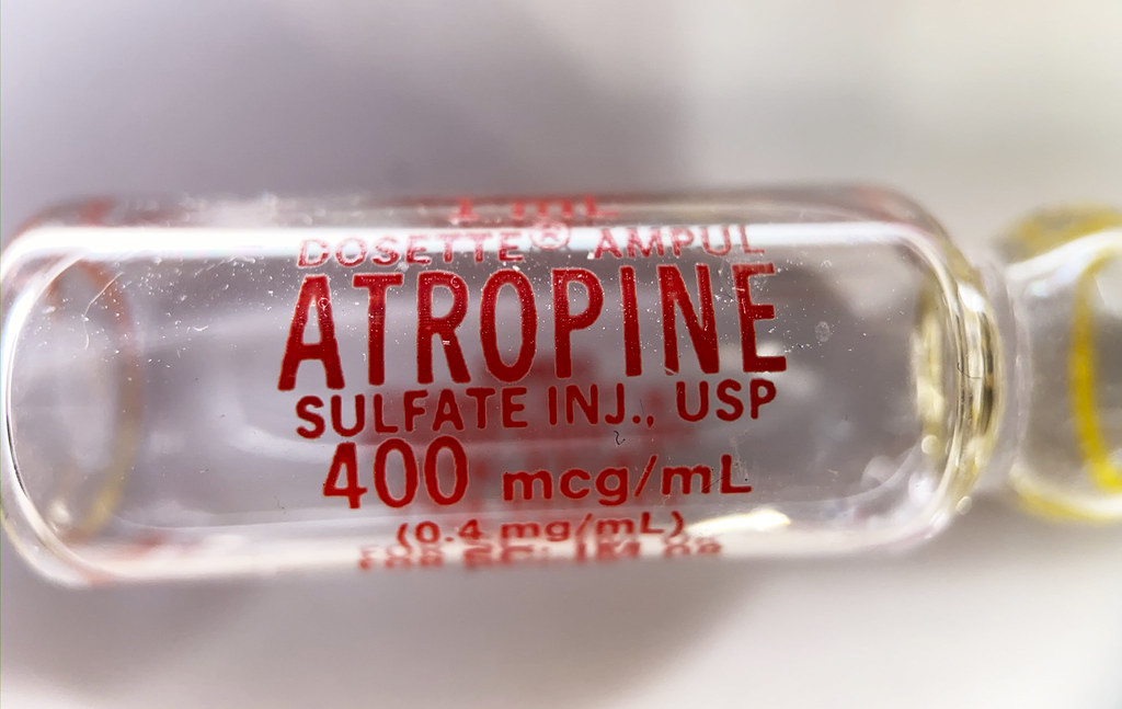 Atropine by tomteske, on Flickr Atropine by tomteske, on Flickr
And speaking of bees, actually found a hive under a boulder in the middle of a drainage not too far from said datura plant. Have not found a living hive in years around here so this was kind of nice to see even thought the bee traffic was light. You'll need to click on the image twice to see the clip.
 IMG_3772 by tomteske, on Flickr IMG_3772 by tomteske, on Flickr |
4/21/2020
Topic:
Domeland/Wind Caves
tommy750
|
Rocko1, here's a petroglyph you walked right by on the way to the wind caves. Looks like another petroglyph down in Pinto Canyon a little ways to the south. The ruler is being held by Jeff Sagun, BLM archaeologist, who called it a tortoise. Not aware of any water source in the Coyotes except maybe a few tinajas. Definitely a lot of slots, mining stuff, fossils and amazing scenery out there.
 Tortoise Petroglyphs (2018_09_25 07_05_23 UTC) by tomteske, on Flickr Tortoise Petroglyphs (2018_09_25 07_05_23 UTC) by tomteske, on Flickr |
5/11/2020
Topic:
Cleveland NF
tommy750
|
Nice pics Rocko1. Glad to see water down in Storm. Last time I was in that area was early 2019 and that drainage was bone dry. You ever looked around Oasis Spring? Assuming that's where most of that water is originating from. Now to continue Daren's hijack of your post, here's another ebike pic up in McCain. Gunna have to step up my game to get that fully accessorized look Daren's bike has
 IMG_3881 by tomteske, on Flickr IMG_3881 by tomteske, on Flickr
Ziphius, you know what this cute fuzzy plant is?? Can't say I've ever noticed it before.
 IMG_3895 by tomteske, on Flickr IMG_3895 by tomteske, on Flickr |
5/14/2020
Topic:
E-Bike Build
tommy750
|
For the briefest of moments before Daren's ebike build was complete, I relished watching him struggle to keep up with me! Sadly, those days are over. Great build Daren. You are a multi talented guy! You ever though about getting one of those helmet thingies to protect your bean?? In camo of course |
5/31/2020
Topic:
Colorado Desert From The Air
tommy750
|
Got a relatively inexpensive drone (Mavic Mini) recently to see how the desert looks from above. Went out on several trips this month to photograph known cultural sites and a couple things I found on GE that may or may not be "real." Would rate my drone flying skills as comparable to a teenager on Day 1 of Driver's Ed but haven't crashed it yet so happy about that. All of the pics are non ABDSP
Here's an archaic site near Ocotillo described by Begole back in the 70's.
 IMP-110 by tomteske, on Flickr IMP-110 by tomteske, on Flickr
Tool were typically rather large and crude and pottery/small projectile points many years in the future. Here's a couple stone tools still lying on the ground. Both are made of the commonly used green porphyric metavolcanic (that green spotted stuff) rock and both heavily patinated indicating they've been there a long time.
 IMP-110 Tool by tomteske, on Flickr IMP-110 Tool by tomteske, on Flickr
 IMP-110 Tool2 by tomteske, on Flickr IMP-110 Tool2 by tomteske, on Flickr
Was pretty sure I'd found a new geoglyph when I spotted this guy but apparently it has previously been recorded and is associated with a large quarry site for, you guessed it, porphyritic green metavolcanic rock. The geoglyph is a serpentine line about 65-70 meters long. Tire tracks are in the top middle of the pic.
 Geoglyph Drone by tomteske, on Flickr Geoglyph Drone by tomteske, on Flickr
 Geoglyph by tomteske, on Flickr Geoglyph by tomteske, on Flickr
 Geoglyph2 by tomteske, on Flickr Geoglyph2 by tomteske, on Flickr
I think this is a geoglyph that was transected by Old Hwy 80 years ago and even more so by I-8.
 Geoglyph by tomteske, on Flickr Geoglyph by tomteske, on Flickr
Nearby cleared circles on a bench overlooking the Ocotillo area.
 Rock Circles by tomteske, on Flickr Rock Circles by tomteske, on Flickr
A large cleared cicle with a smaller rock circle in the perimetry on a bench overlooking Ocotillo.
 Rock Circle2 by tomteske, on Flickr Rock Circle2 by tomteske, on Flickr
 Rock Circle by tomteske, on Flickr Rock Circle by tomteske, on Flickr
Went out today and took pics of the lake bed of Ancient Lake Cahuilla. Definitely a different perspective.
 Red Onions by tomteske, on Flickr Red Onions by tomteske, on Flickr
 Red Onions3 by tomteske, on Flickr Red Onions3 by tomteske, on Flickr
 Tree on Canal Bank by tomteske, on Flickr Tree on Canal Bank by tomteske, on Flickr
If you can't fathom how the Imperial Valley can use 2M acre feet of Colorado River water every year, wonder no longer.
 River Water2 by tomteske, on Flickr River Water2 by tomteske, on Flickr
 River Water by tomteske, on Flickr River Water by tomteske, on Flickr
Would really like to do more drone photography with a nicer camera after I learn how to not crash. Shows a completely unique perspective of what we've seen a million times. Enjoy! Tom |