5/14/2012
Topic:
Villager Peak
rockhopper
|
Hi all fellow friends of the Anza borrego desert area. I am long time visitor to this fourm and have enjoyed reading your posts and following along on your awesome trips.
Me: Well, my father brought me to the Anza Borrego area the first time back in 1964 when I was 6 years old following the El Centro earthquake, which left open cracks in the ground thru-out the desert area. Neat! I remember feeling how fantastic is was, with the incredible mountians and canyons. Let's just say I have been very fortunate to have worn out many boots doing what I love, Hiking!
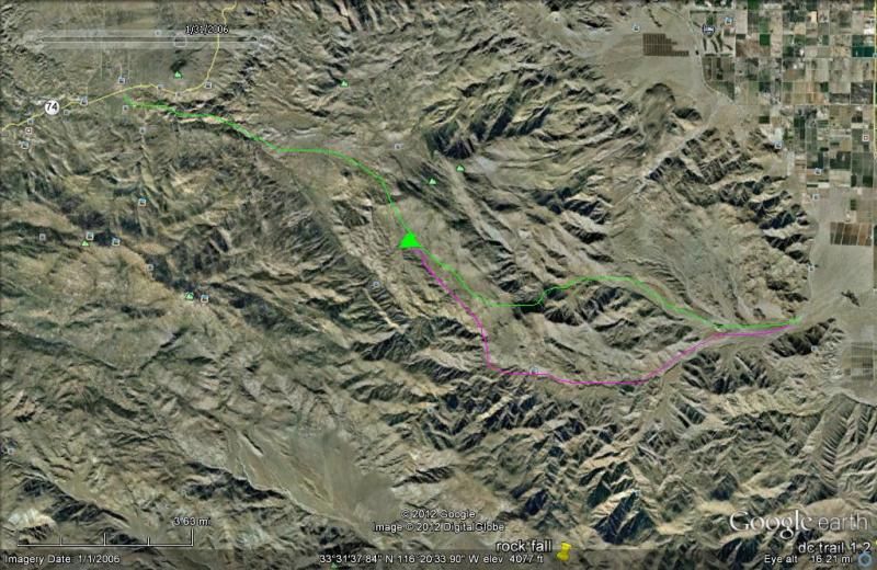
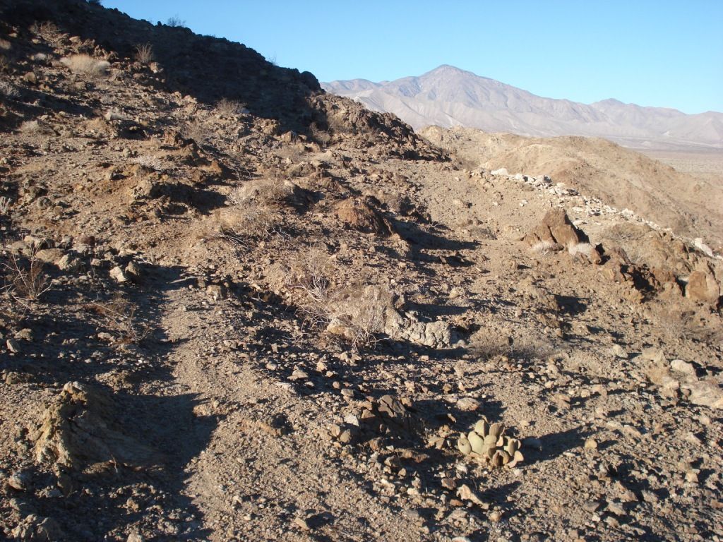
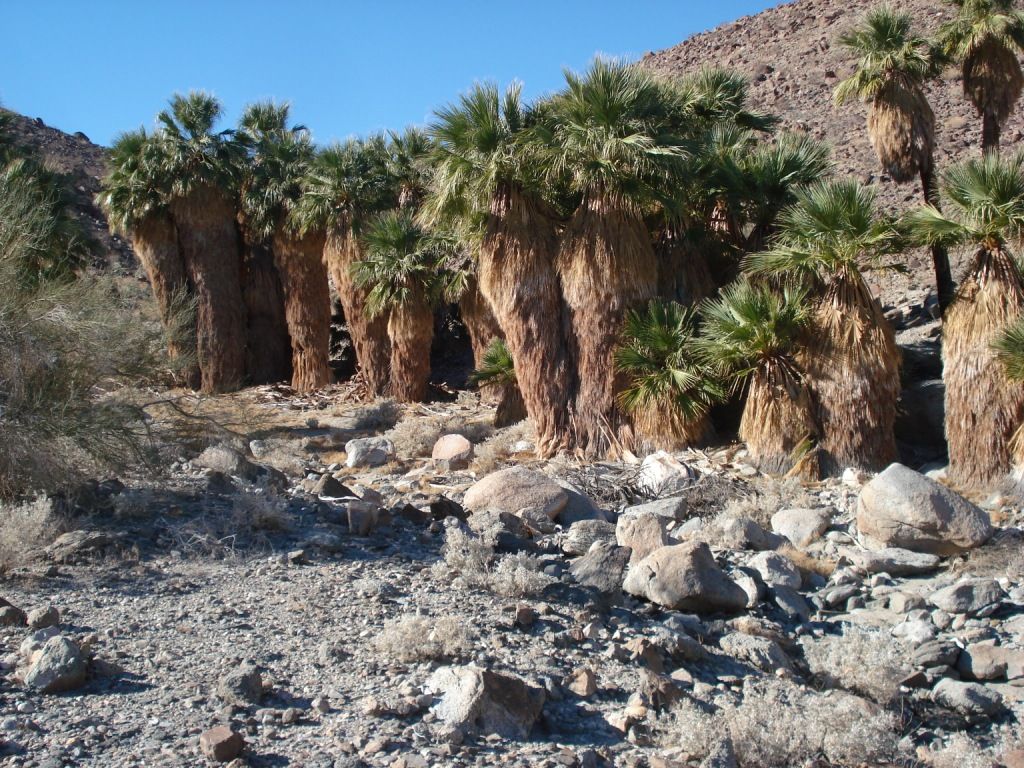
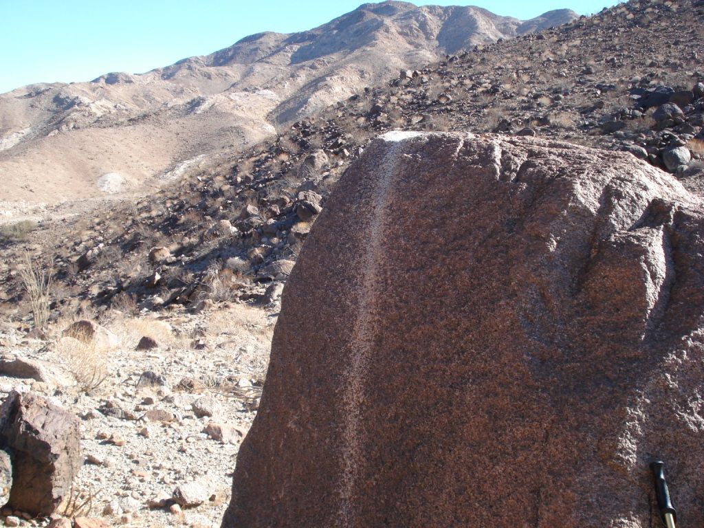
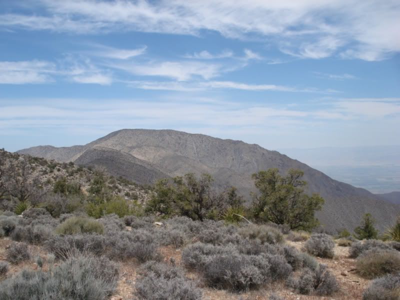
Enough of me! on to Villager peak. This one has been on my list of things to do for quite a while. About 15 years ago a friend and I made it up about half way and turned back due to daylite issues, (slept in too long, too long of a breakfast, etc....) Fast forward 2012. With summer fast approaching and temps nearing 100 deg., I saw my chance the first week of May this year. A low pressure was moving in and highs only in the 80's. My plan was to leave at dawn and climb into the cooler air by mid day. Packed a lunch and 4 liters of water.
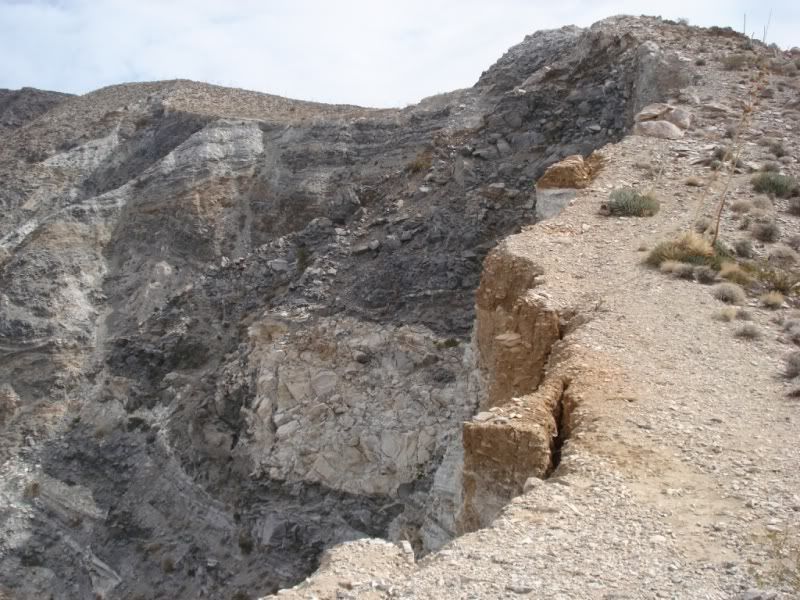
[IMG]http://i67.photobucket.com/albums/h294/metalmeister/ABDSP/Villager%20peak/santarosamtn013.jpg[/IMG]
Clark fault below and the Luke fault scarp
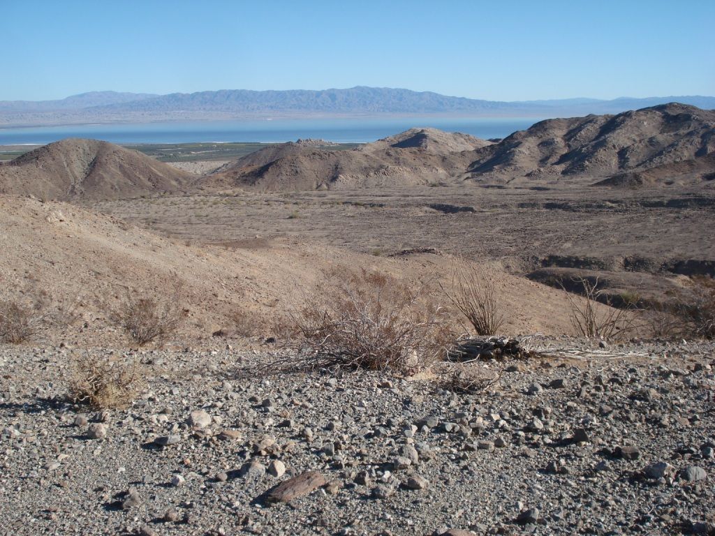
[IMG]http://i67.photobucket.com/albums/h294/metalmeister/ABDSP/Villager%20peak/santarosamtn121.jpg[/IMG]
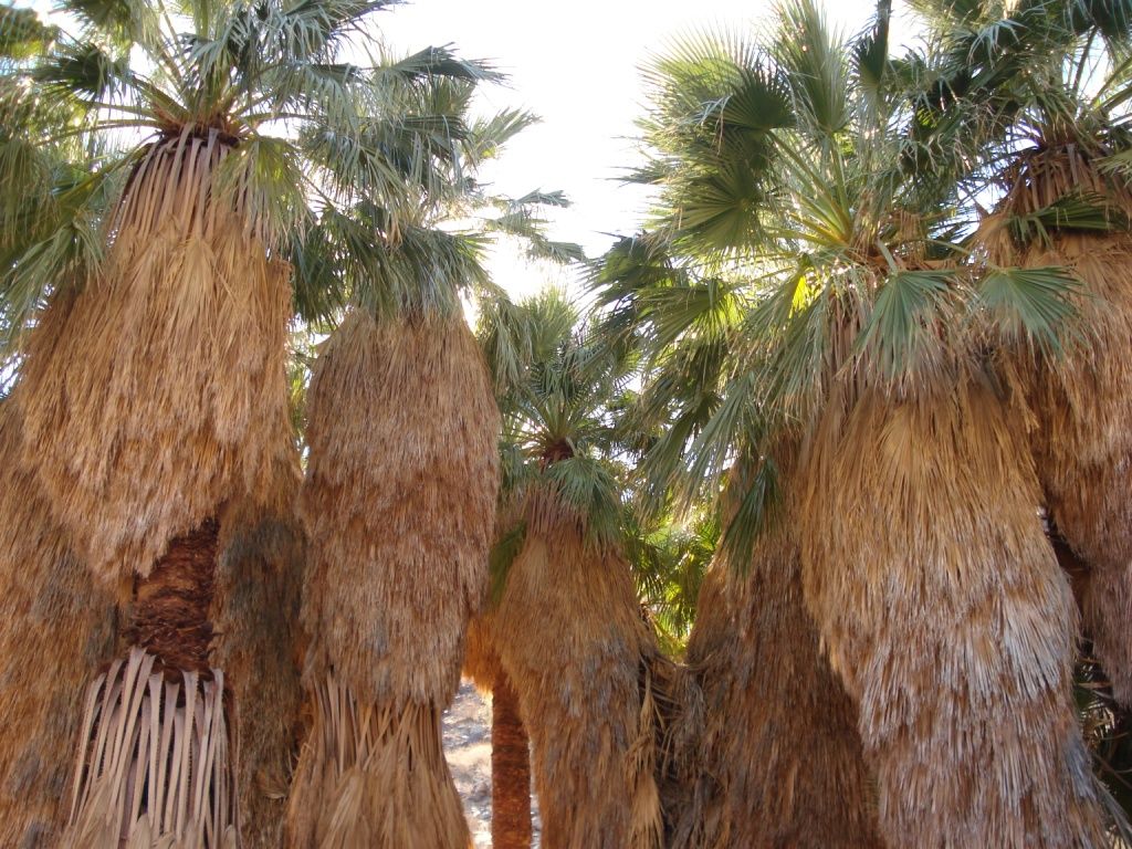
Rosa and Rattle Snake springs
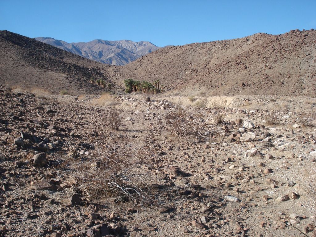
[IMG]http://i67.photobucket.com/albums/h294/metalmeister/ABDSP/Villager%20peak/santarosamtn092.jpg[/IMG]
Next year!
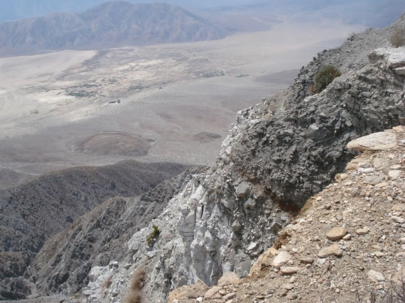
[IMG]http://i67.photobucket.com/albums/h294/metalmeister/ABDSP/Villager%20peak/santarosamtn030.jpg[/IMG]
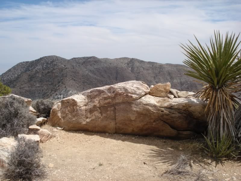
western scarp yikes! Be careful here.
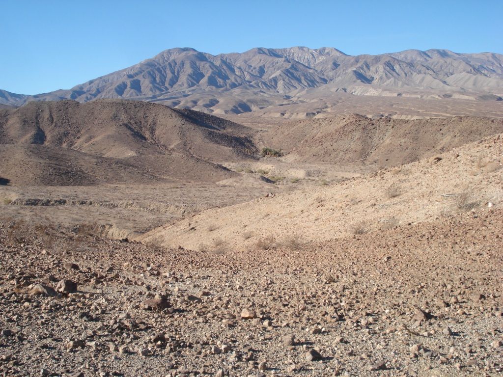
[IMG]http://i67.photobucket.com/albums/h294/metalmeister/ABDSP/Villager%20peak/santarosamtn046.jpg[/IMG]
Villager false peak and Santa Rosa peak beyond.
[IMG]http://i67.photobucket.com/albums/h294/metalmeister/ABDSP/Villager%20peak/santarosamtn057.jpg[/IMG]
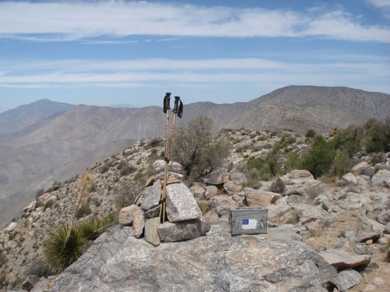
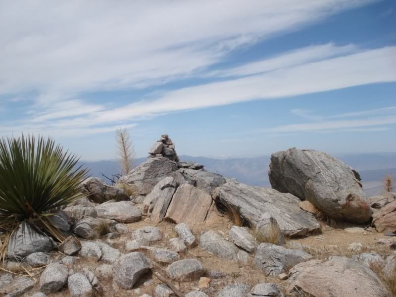
Villager Peak :-)
[IMG]http://i67.photobucket.com/albums/h294/metalmeister/ABDSP/Villager%20peak/santarosamtn053.jpg[/IMG]
Rabbit Peak, that was a tough one 25 years ago. We came up the east side Barton canyon route. I have some neat old photos some where. I will find when Rabbit comes up.
[IMG]http://i67.photobucket.com/albums/h294/metalmeister/ABDSP/Villager%20peak/santarosamtn105.jpg[/IMG]
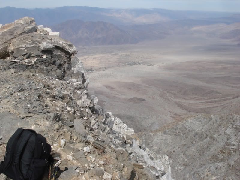
Awestruck everytime at "the edge"
Well that's it. Finally did it! Neat hike with superb views in all direction in nearly every direction. Thanks for letting me share.
Regards,
Rock hopper
<em>edited by rockhopper on 5/14/2012</em> |
5/14/2012
Topic:
Villager Peak
rockhopper
|
dsefcik wrote:
Welcome to the forums rockhopper!
Those are some great pictures, I really like the Santa Rosa and false Villager Peak one. Did you see anybody else out on the trail, any wildlife?? What were some of the most recent entries in the register? What was your total time up/down?
Thanks!
Saw no one else during the entire day. Oddly, cell phone reception was very good!
Wildlife: Thanks for reminding me! Lot's of birds swooshing by my head Close! and Fast! on the way up. They must have gotten bored with me after a while as not as many on the way back down. Sorry don't know the species but dark top, light bottom about 6" long and Fast! Lots of sun bathing lizards. Lots of insects, bees hovering around the cactus flowers at about the 2000 ft. elev. and up. Best of all, no Rattle snakes! actually , no snakes!
Register: There were about 6 or 7 mini spiral note pads in the register. The earliest was from 1990, the last one before me ( May 2nd 2012) was a Gent from Temecula on April 28th.
Hike time: Day hike. 5 hrs up, 1 hr. ontop and 5 hrs down.
Water Cache report: To whom ever left water. About 1/2 Gal. left at about 4000 ft. near the trail, and about 1/2 gal at summit. I added to the summit cache.
Regards,
Rockhopper
edited by rockhopper on 5/14/2012
<em>edited by rockhopper on 5/14/2012</em> |
5/15/2012
Topic:
Villager Peak
rockhopper
|
ziphius wrote:
That's a BIG ONE rockhopper! Welcome to the forum. Great place to learn about ABDSP and share. Villager is on my "to do" list. You say that you carried only 4 liters of water with you and left some at the summit? How much did you drink?
That 'western scarp yikes' photo... is that the actual trail where your backpack is sitting? Or did you wander over to 'the edge'?
Jim
ziphius,
Thanks, Great forum. I drank all my water except the third of a liter I left at the summit water cache. The trail basically follows the western escarpment all the way up. Get as close as you wish!
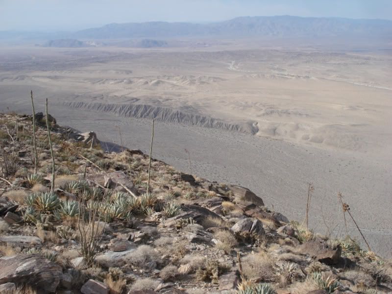
[IMG]http://i67.photobucket.com/albums/h294/metalmeister/ABDSP/Villager%20peak/santarosamtn102.jpg[/IMG]
The trail
[IMG]http://i67.photobucket.com/albums/h294/metalmeister/ABDSP/Villager%20peak/santarosamtn026.jpg[/IMG]
More "trail"
[IMG]http://i67.photobucket.com/albums/h294/metalmeister/ABDSP/Villager%20peak/santarosamtn056.jpg[/IMG]
Villager peak looking west
Regards
Rockhopper
edited by rockhopper on 5/15/2012
edited by rockhopper on 5/15/2012
<em>edited by rockhopper on 5/15/2012</em> |
5/15/2012
Topic:
Villager Peak
rockhopper
|
hikerdmb wrote:
Welcome to the forum and nice photos. I agree, the pic of the western edge is great. How much of the climb to the top of Villager is on a use trail? Did you have to use your hands or scramble at all? Any good camp spots up that way?
Thanks for sharing,
David
hiker,
I agree the western edge is truely fantastic. Feeling I get is very similar to San Jac northern "edge" or High Sierra eastern escarpment, but it's fairly close to home! :-)
I followed the "normal" route so just hiking poles and the ol' boots. No scrambling "off trail" on this trip, but looks like plenty to the east towards "rosa" and rattle snake springs.
Noticed several good camping spots up around the 2000 ft and 4000 ft mark.
[IMG]http://i67.photobucket.com/albums/h294/metalmeister/ABDSP/Villager%20peak/santarosamtn086.jpg[/IMG]
Nice spot with a view!
Regards,
Rockhopper
edited by rockhopper on 5/15/2012
<em>edited by rockhopper on 5/15/2012</em> |
5/16/2012
Topic:
Hike through Banner mine district
rockhopper
|
Looks like you had a great time! The whole Chariot canyon, Rodriguez canyon, Oriflame canyon, Granite mountian, Julian areas truely fantastic for exploring. You
found your Gold mines! Man, those old timers were tough, blasting and hand picking through that hard rock for the Gold ore.
btw USGS topos show many shafts and tunnels in the Chariot canyon area. I like Google earth. It will show even the small mine tailings.
My mine tunnel/shaft exploring days are way behind me. Don't ask!
<em>edited by rockhopper on 5/16/2012</em> |
5/19/2012
Topic:
Hike through Banner mine district
rockhopper
|
herofix wrote:
Thanks all for checking out my report.
Ziphius, I thought the same thing about the liability for property owners, but there were no signs and only 1 fence or gate that I saw on that whole trek, and that was around the caved-in entrance in the last pic...but it was wide open. I wouldn't have hopped a fence to gain access but some might and could get hurt.
Daren, thanks again for the map and detailed info. You did indeed mention that it was a fire road but when viewed from above it was hard to gauge elevation. Still, I'm certain that it was much better than coming in from the Fages trail direction. I definitely got plenty of exercise walking up there! I think I may head out there again in the future, but NEXT time I'll have a flashlight AND I'll drive at least partway up first!
Oh and the trash in the mine entrance was weird. The box with blue writing says "Kirkland Butter" (Costco), so it's clearly not historic miner trash! My bet is that the shooters from the nearby range dumped their crap in there.
And Rockhopper, your comment about your mine exploring days begs for more details! Do tell...
Dan
edited by herofix on 5/17/2012
herofix,
Well, here goes. My first mining and tunnel experience was back in the 1960's when my parents took my brother and I to the Calico mining ghost town outside of Barstow. After that, I was hooked. Reading about the 49's and the California gold rush only fueled my interest. My brother soon lost intrest and then it was just me and some local friends I would "talk into" exploring gold mining regions. Over the years , jeep/camping trips in California, Arizona and Baja of mine exploring, peak bagging we never ran into "Major"problems.
We learned early on to respect active claims and were only run off once from what we thought was an abandoned mine claim. From that point on we focused on Federal or BLM lands to get our "mine fix". A friend of mine and I planned the mother of all exploration trips. We both took off about two weeks to hike and explore the Panamint / Inyo range near Death valley using USGS topos to guide our way. We slept on the ground, in old mining cabins, it snowed, our stove broke, we had to ration food. God was telling us something here, but we continued on. Did I mention my friend Greg also brought his dog along. He brought his dog! About halfway into our trip of tunnel exploring we all entered yet another abandoned horizontial tunnel into the side of the mountian with with our flashlites and our curosity. No big deal, no cave in's, tunnel wood shoring still in place. We had gone through some long tunnels before, even through a mountian and came out on the other side! So we continued on. A few hundred yards in, then ...........we heard a "swooochhhhhh..........we turned around , looked down and saw we just walked by a vertical shaft on the floor, we didn't even see! The dog (Kima) following behind us close walked right off into the shaft. The sound we heard was the dog falling through the air. We were stunned, heard no impact, no barking, just silence. Greg my friend, immediately started climbing down the vertical shaft mine timber lagging. I'm saying, this nuts, he just climbed down, I yelled I was going back to the car to get rope.Out of breath and back at the car, then realizing the car was locked and he had the car keys! No cell phones back then, probably wouldn't work anyway where we were. I'm thinking, oh #%*!. So I head back to the mine. This was a major hike just to get there. I finally find the shaft, yelling down the shaft... nothing....no way i'm going down this thing! I Can't even see the bottom with my large flashlite. I slowly make my way out of the tunnel, back down to the dirt road, it's getting dark and Cold, And all of my gear is in the car! All I have is my daypack, binocs. water and few items. Before I break into his car, I decide to head up to a ridge overlooking the general area of shafts and tunnels comming out of the barren rocky terrain. Thru my binocs I am scanning the entire area, when all of a sudden... There he is! Walking down a mountian miners trail with the his dog across his back. I am soooooo releaved. Finally, what the heck happend? He said when he got to the bottom of the shaft, about 100 ft Deep the dog landed on a cone of dust at the shaft bottom about three feet high and softend the impact. My friend was ok, his dark shorthair dog , kima was coated in white powder from the dust and alive! Amazingly, he was walking very slowly the next day. Luckly we had a happy ending. We were dirty, tired, hungry, and very smelly and very glad to be alive! That, was the end of my abandoned mine exploring for good! I just stick to ontop of the Earth boots on the ground hiking for me :-)
So there you asked, sorry for the long post
Regards,
Rockhopper
edited by rockhopper on 5/19/2012
edited by rockhopper on 5/19/2012
edited by rockhopper on 5/19/2012
<em>edited by rockhopper on 5/19/2012</em> |
5/23/2012
Topic:
Big cool-down predicted for the weekend
rockhopper
|
I say go for it! It may be one of the last days this season to have the highs in the 70's. take some neat pics |
5/25/2012
Topic:
Big cool-down predicted for the weekend
rockhopper
|
Latest weather update calls for strong winds in mountians and desert Friday nite. Be careful if you are going. |
6/7/2012
Topic:
Best Mylar Ballon Trip
rockhopper
|
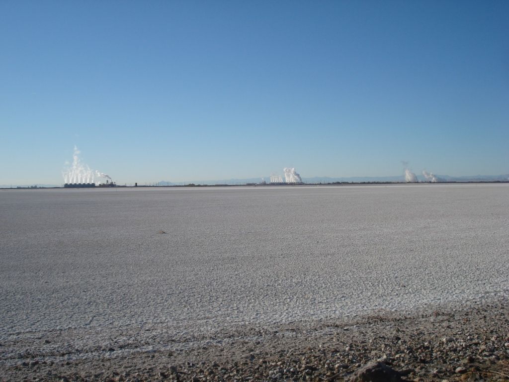
Wow, neat shot of the smoke "dipping" into Clark dry lake. Was that the smoke from the Banner / Granite mountian fire?
Regarding balloons: I think I have spotted balloons on every back country desert hike I have been on. From shriveled up rubber balloons on the desert varnish floor to wrap around the cactus mylar balloon type.
<em>edited by rockhopper on 6/7/2012</em> |
6/28/2012
Topic:
Squaw Tit and Table Mountain
rockhopper
|
Nice photos! I need to check out that area some time instead of wizzing by on the 8.
tommy750 wrote:
dsefcik wrote:
Awesome post...I love those night photos, I want to learn how to do those. The powerline photo I am guessing you painted with a flashlight or something? I can only guess the guzzlers work, BLM has those things everywhere. Like I said before, I have found 7 or so just in the Table Mtn area, there is actually one right at the bottom of Tule Mtn next to Sacatone Overlook also. ABDSP has them also but they are of a different design. Last time I went to Squaw Tit there were no BP there, that mobile vehicle is recent, last couple of years or so.
That battery was maybe used to blow up stuff in the quarry? Did you find all of the white post markers? Doesn't look like you crossed down into the quarry so I am guessing not.
You should continue to explore that area, there are a lot of really neat things to see the deeper you go north/west.
Saw a few of the white markers in between Squaw and the summit. Do you know if they marked some boundary? Yeah, want to go back and visit the entire NW portion. That's a really neat pictograph photo. Need to find that! The power lines were converted to BW with a high contrast red filter just to give it a more omninous look |
7/8/2012
Topic:
Catavina Pictographs in Central Baja
rockhopper
|
Nice cave pics! Yes very similar. Looks like they were counting marks. Number of peoples in local tribe? Number of large game kills?
Wonder what the rectangular grid is all about. Family unit?
Thanks for sharing |
7/14/2012
Topic:
Rain in Anza Borrego today
rockhopper
|
Excellent! Love those desert rains. Yes we also had a few sprinkles out here on the coast. Felt great, the sub-tropical Mexican air mass moving through. |
7/14/2012
Topic:
2012 Bighorn Sheep Count
rockhopper
|
Good show Daren! Great photos. You all had a very important and worthy expedition. I might be interested in the upcoming years if I can take the heat. I am the first person in the entire family and extended family to first break a sweat walking! The only time I saw a huge group of Big Horn sheep at one time was when I had my wide angle lens firmly attached to my camera. We all caught each other by surprise, as often with my experiences with the Big Horn. The film photos show the Big Horn sheep as tiny horned sheep. Of course this was hiking down above them decending in the 11,000 to 10,000 ft zone further up the state. Beautiful creatures. Again fantastic effort on your part.
I belive this is rattlesnake spring:
Photo taken at about the 3000ft elevation
[IMG]http://i67.photobucket.com/albums/h294/metalmeister/ABDSP/Copyofsantarosamtn016.jpg[/IMG]
edited by rockhopper on 7/14/2012
<em>edited by rockhopper on 7/14/2012</em> |
7/15/2012
Topic:
2012 Bighorn Sheep Count
rockhopper
|
Yes, It was May this year during my hike to Villager Peak. How is the hike going to rattlesnake spring? It looks like you could head off the Villager trail and down and up to the spring. The canyon trail must be interesting. I would like to camp out during a flash flood sometime, just to see some of these dry canyons flowing.
Those are some fantasic photos at Rattlesnake spring. The rear ends at the watering hole surrounded by bees made me chukle for two reasons. The bees being the other.
Did anyone go to the "Natural rock tanks" ?
dsefcik wrote:
That looks like it, did you take that photo from the ridge going up to Villager?
rockhopper wrote:
I belive this is rattlesnake spring:
Photo taken at about the 3000ft elevation
[IMG]http://i67.photobucket.com/albums/h294/metalmeister/ABDSP/Copyofsantarosamtn016.jpg[/IMG]
<em>edited by rockhopper on 7/16/2012</em> |
7/16/2012
Topic:
Dream Find!!!
rockhopper
|
A big WOW! I would go back and check on it from time to time being 10 years ago. Maybe contact the state museum for a retreval of such a outstanding find!
Could you get your hand inside it? Anything inside? Usually held water right? How far from a flat camping spot was it?
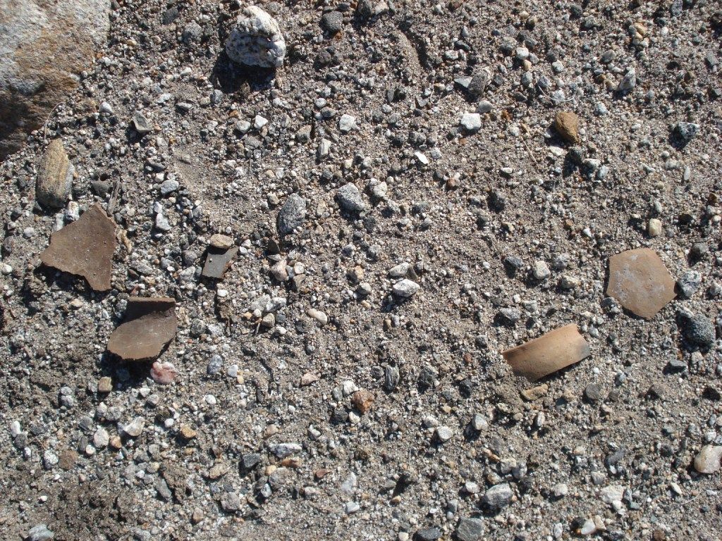
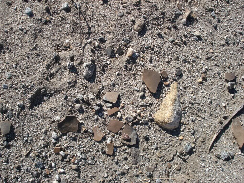
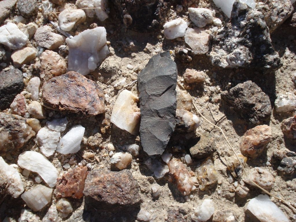
This is what I usually come across during cross country treks across the ABDSP. Some times in the strangest places. Sorry for the lousy cell phone pic. Sunglasses for scale. As you said please leave for others to enjoy!
[IMG]http://i67.photobucket.com/albums/h294/metalmeister/ABDSP/10martinezsherd.jpg[/IMG] |
7/19/2012
Topic:
Best Mylar Ballon Trip
rockhopper
|
I saw this today. Not in ABDSP, but in the same county!
5,000 with-out power due to Metallic balloon.
http://www.utsandiego.com/news/2012/jul/19/more-than-2250-without-power-in-vista/
<em>edited by rockhopper on 7/19/2012</em> |
7/19/2012
Topic:
Older Anza Borrego maps
rockhopper
|
Hello all. Found these while looking through "my stuff". While not real "old" I thought this would be a start of an interesting thread.
Please continue to add any older maps you might find interesting. Older map information is often "removed" and or missing from the later generation of maps
and is of great information to us, the "explorer" community.
Map A : Army Corp of Engineers. 1953 road data.
[IMG]http://i67.photobucket.com/albums/h294/metalmeister/ABDSP/CopyofABUSGS004.jpg[/IMG]
Map B: Army Corp of Engineers. 1977 road data.
[IMG]http://i67.photobucket.com/albums/h294/metalmeister/ABDSP/CopyofABUSGS002.jpg[/IMG]
Few points of interest.
1. Notice the old spelling of "borego" on map A
2. Notice the new location of Borrego Springs on map B
3. Notice the town of Ranchita moved to the East on map B
4. Map a was created prior to the "ABDSP"
edited by rockhopper on 7/19/2012
<em>edited by rockhopper on 7/19/2012</em> |
7/23/2012
Topic:
California State Parks Director Resigns
rockhopper
|
I hope this money specifically designated for the state parks dosen't end up going down into the states general fund black hole.
When, where is the protest? |
7/23/2012
Topic:
Border Angels
rockhopper
|
All's I know is when I tried to cross from Chile into Argentina, I was greated with machine gun toating army guards searching my luggage asking for my "papers", which I had.
Minor delay, no problem , on my way.
All these fatalities could be avoided simply by securing a proper travel visa or passport. Those souls are paying thousands to be dumped on the border. Sad just sad. |
7/23/2012
Topic:
Older Anza Borrego maps
rockhopper
|
Here is a close up of the earlier posted photos showing the new spelling and relocation of "Borrego Springs"
Army corp of Engineers relief maps
Note the location of the "borrego sink" and the new "Desert Lodge"
1953 road data map
[IMG]http://i67.photobucket.com/albums/h294/metalmeister/ABDSP/CopyofABUSGS008.jpg[/IMG]
1977 road data map
[IMG]http://i67.photobucket.com/albums/h294/metalmeister/ABDSP/CopyofABUSGS009.jpg[/IMG]
Another point of intrest I thought I would share, although slightly outside the ABDSP is the Lake Henshaw water levels from the 1953 map vs the 1977 map
1953 road data
[IMG]http://i67.photobucket.com/albums/h294/metalmeister/ABDSP/CopyofABUSGS006.jpg[/IMG]
1977 road data
[IMG]http://i67.photobucket.com/albums/h294/metalmeister/ABDSP/CopyofABUSGS005.jpg[/IMG]
Pretty much confirms what we already know. Scientists have confirmed the the deserts have moved North approx. 100 miles in the past 100 years.
My feeling is the the warming from the last ice age cycle is still continuing. When does the ice age cycle reverse and rainfall increases once again. Soon I hope!
edited by rockhopper on 7/23/2012
edited by rockhopper on 7/23/2012
edited by rockhopper on 7/23/2012
<em>edited by rockhopper on 7/23/2012</em> |
7/23/2012
Topic:
Older Anza Borrego maps
rockhopper
|
Hi Daren,
Here is one link to the general information.
http://www.public.asu.edu/~atejs/stories/F04/downloads/F04_kline_migration.pdf
I will try to find source for the specfic quote. It's been a while. I will try to locate.
Moving to Southern California in 1962, I can definately say I have seen the change in the trees and vegitation.
I have some photos taken 20 years apart somewhere on "film" clearly showing the landscape "drying out" |
7/28/2012
Topic:
Older Anza Borrego maps
rockhopper
|
Surf,
Maybe those species will show up in ABDSP in the future unless a new ice age cometh |
7/28/2012
Topic:
Dezert Magazine July Printed Versions available
rockhopper
|
Thanks for posting. I'll check it out. |
8/2/2012
Topic:
Looking for tinajas on San Clemente Island
rockhopper
|
Excellent report! Thanks for sharing. |
8/4/2012
Topic:
Looking for tinajas on San Clemente Island
rockhopper
|
Wow, San Nicolas looks like a totaly different geology. I did a report on the channel islands back in the 1970's in high school. I have only set foot on Catalina several times.
There is great history on the channel islands. Imagine back in 1542 when Cabirllo encountered "numerous" natives on canoes circling his boat at the "islands". Heck he even died there. He is supposed to be buried on Anacapa but some say Catalina. His burial mound has never been found.....
http://socalhistory.org/biographies/juan-rodriguez-cabrillo.html
btw I am partial to remaining by the coast in August
<em>edited by rockhopper on 8/4/2012</em> |
8/24/2012
Topic:
Bachelor Party in Early May Help...
rockhopper
|
Wow, planning 9 months out. Drinking only water for 2 days for a bachelor party? Oh man, how about doing a ABDSP trip in Nov.-March and doing
the bachelor party in Vegas!
If you insist on going in May, here is my 2c
Plan A) Hot weather: Do the San Jac hike as mentioned
Plan B) Cooler weather ( For me, that would be below 80F for desert back packing. OK, I was not a Navy Seal. I'm not worthy! )
How about a Cactus spring trail hike from hwy 74 down to hwy 86. You will be hiking on a 1000+ year old native american trail route.
Hike from the top to the spring day 1 ( water fill up at horse thief spring) Day 2 down Auga alta or Martiniz canyon with a stop
at Jack Miller 1925 rock house and on down. I know this is just out side of the ABDSP but close enough for me.
btw Bring food! Two days of back packing make anyone very Hungry! |
8/25/2012
Topic:
Bachelor Party in Early May Help...
rockhopper
|
anutami,
Yes it's in Schad (r.i.p.) Inland Empire book. I've hiked down from hwy 74 to cactus spring with a side trip to Martinez peak and back to hwy 74 on a two day trip.
I have also made one trip up Martinez canyon and four solo trips up Auga Alta canyon to near cactus spring but never made it to the spring! I would rather hike up
Martinez or Auga Alta than down with a pack. Hiking poles recommended. I can't believe the hikes we did back in the 70's and 80's with out poles!! Anyways, you will need
2 vehicles , one with 4wd for the desert entrance. I've gone real far with my 2wd after the winter rains on hard packed sand. I might be game for the trip.
BTW I spent 50/50 of my local hiking time in the ABDSP and the Santa Rosa mountians. I know it's outside the ABDSP in the "other" county, but to me it all
"flows" together from below sealevel to the mountian peaks. Hoping for a good wet winter!
edited by rockhopper on 8/25/2012
edited by surfponto on 1/2/2013 |
8/27/2012
Topic:
Yuha Well and Geoglyphs
rockhopper
|
Nice report. That's getting out towards the Yuma to San Diego wooden road. Yes? Nice photos! Hats off you all troopers heading out into the 110 Deg. heat. I saw Ocitillo Wells hit 120 Deg. a few days back. When Death Valley hit 126Deg. OMG! Those turbine guys getting it. I suppose. Staying coastal and surfing google earth for next next expedition.
Again, thanks and interesting report. |
8/27/2012
Topic:
The Destruction of Ocotillo Ca
rockhopper
|
Those turbines look larger than the ones at the I-8 summit. Sad. |
9/3/2012
Topic:
Lost Valley
rockhopper
|
My brother and I hiked through Lost Valley about 20 years ago. We hiked out of Warner Hot Springs (Closed Now ) long story. We hiked from the Hwy where the PCT intersects and headed North East. Saw no one else. Oak shade canopy a long much of the trail. Running water in the local creeklets. We went in the Winter. First saw Lost Valley from a top the Hot Springs Mountian look out tower and on USGS topo maps. Hot Springs Mountian is the tallest peak in San Diego County. Drove my old truck almost to the top! Lost Valley is truely a remote part of Riverside county. Bring water if no recent rains. Watch for deer ticks in the spring time.
<em>edited by rockhopper on 9/3/2012</em> |
9/8/2012
Topic:
Gettin the itch...
rockhopper
|
In addtion to my hike suggestion on the prior "bachalor party" post. I have rockhose caynon area on the list. I may head back to the Santa Rosa indian ruins on a multi day hike.
I am interseted in completing the hike from the S.R. indian ruins follow the ancients trail east over into Martinez canyon or head up into "Black Rabbit" on the USGS topo. It's
pretty remote back up in there with some old growth forest and neat camp sites, but need a winter rain. The first trip may be from toro peak down into Black Rabbit or Nicolas
canyon. As the weather cools I will move the trips lower in elevation. Spending some time surfing Google Earth  |
10/5/2012
Topic:
Ocotillo Express Wind Energy Project Progress
rockhopper
|
Too bad for those Ocotillo folks. That view of the Carrizo mountains heading out on the the S2 toward the county line / check point will never be the same.
I would have demanded some compensation for reduced property values (views). The only plus is the energy is from the wind , not from burning hydrocarbon based fuels
for electric generation. |
10/14/2012
Topic:
Border patrol finds artifacts
rockhopper
|
Some of you have probably seen this. Thought is was kinda neat. I know it is east in AZ but still way cool after all these years!
http://news.yahoo.com/blogs/sideshow/arizona-border-patrol-agents-discover-ancient-artifacts-190745819.html
[IMG]http://i67.photobucket.com/albums/h294/metalmeister/misc/j0283701.gif[/IMG] |
10/15/2012
Topic:
Chariot, Oriflamme, Rodriguez MTB Loop
rockhopper
|
Superb ride! Are you sure the gate was locked? I usually pull up to the gate and looks locked with the chain but the lock has never been fully shut . Maybe some bozo closed it.
In 25+ years of going out there ,I have never been locked out ( or in ). That would be a BUMMER coming all the way up from Oriflame or Rodriguez canyon. Looks like I need to carry my B.A. Bolt cutters in my rig now. Done those routes many times. There is a cool tourmaline mine near the PCT on the Rodriguez side. Lots of gold mines on the other side. The shack I belive was a rancher and toll shack. Lots of deer out there. I prefer to go mid week also, to avoid the week end yahoo's. Nice report.
<em>edited by rockhopper on 10/15/2012</em> |
10/25/2012
Topic:
Rockhouse Cyn Road Conditions Report
rockhopper
|
Look forward to the report. I just admire being inside rock house valley. Love that place.
Nice story of the drive in. Last trip in for us on a 4x4 was hard packed sand ( after winter rains). The boulders stopped our Bronco 4x4 about 1/4 mile from
the hidden spring at the entrance to RHC. |
10/25/2012
Topic:
Squaw Tit, Table Mountain and 10 other Benchmarks
rockhopper
|
Doing the U-turn before the S2 check point. LOL! ........I never really had any problems so far. Last time thru I was amazed at the number of
BP agents. Looked like alot of rookies being trained. There must have been 15-20 personal out there on the road at the county line. |
10/29/2012
Topic:
Rockhouse Canyon 4 Day Backpack TR
rockhopper
|
Fantastic photos and great report! I have got to get back out there this winter. I am amazed at how large the valley really is and the unlimited hiking available. You said you hiked to the east once entering the valley. Anything of note? Last trip in our party split at the Santa Rosa Ruins site, my friend and I headed west and our other friend went up and over east toward Martinez / Auga Alta canyon. He said there was a clear old trail. I think that would be a great day hike or loop back pack. I liked the "sweat house" I missed that . Your friend Gary knows the area well. How many times have you / he been hiking the valley? The "crater" may have been a looted burial mound. We saw two burial mounds and a third "unearthed" complete with broken arrow heads near the main ruins at 4000ft elev. The hand cart looks very familiar. I meet a Gold prospector who would huff in a "mini" dredge into the local mountians and gold dredge the normally dry creeks during the winter and spring. He had the same wheels complete with mountian bike tires! I hope I never run into any of the "farmers" yikes! Here is a pic at around 6000 feet Near Nicolas canyon about a mile from the abandoned saw mill on the west side of Toro peak.
[IMG]http://i67.photobucket.com/albums/h294/metalmeister/ABDSP/CopyofSantaRosaMtnsJan1994001.jpg[/IMG]
edited by rockhopper on 10/29/2012
edited by rockhopper on 10/29/2012
<em>edited by rockhopper on 10/29/2012</em> |
11/3/2012
Topic:
Rockhouse Canyon 4 Day Backpack TR
rockhopper
|
dsefcik wrote:
In my Old Time Cattlemen of ABDSP book the author mentions an old indian cemetery on the west base on the Santa Rosa mountains, where Nicholas Guanche was buried. Is that where this was taken?
The author writes that the name of Nicholas Cyn (Nicholias on current topo maps?) was named after him, the last one of the indians to live in the area.
rockhopper wrote:
Here is a pic at around 6000 feet Near Nicolas canyon about a mile from the abandoned saw mill on the west side of Toro peak.
[IMG]http://i67.photobucket.com/albums/h294/metalmeister/ABDSP/CopyofSantaRosaMtnsJan1994001.jpg[/IMG]
We came across the burial ground heading down towards Rock House Canyon from the abandoned sawmill at the base of Toro peak. I could probably find it a gain. It was on knoll with a fantastic view to the south overlooking rock house canyon. I figured they were either white settlers working at the sawmill or native peoples converted to Christianity or a combination of both. Either way if I were buried there I would be just fine with it!
kickin it at the main ruins
[IMG]http://i67.photobucket.com/albums/h294/metalmeister/ABDSP/CopyofSantaRosaIndianRuins1-23-1993007.jpg[/IMG]
Water flowing near Buck ridge after the winter rains
[IMG]http://i67.photobucket.com/albums/h294/metalmeister/ABDSP/CopyofSRMntns005.jpg[/IMG]
Speaking of Martinez canyon.....
Brenda navagating the stream bed
[IMG]http://i67.photobucket.com/albums/h294/metalmeister/ABDSP/CopyofSRMntns012.jpg[/IMG]
Cooling off in Martinez creek
[IMG]http://i67.photobucket.com/albums/h294/metalmeister/ABDSP/CopyofMartinezCanyonJan1993005.jpg[/IMG]
Almost there! Note: this is the pre hiking pole era. The stuff we did with out poles amazes me to this day.
[IMG]http://i67.photobucket.com/albums/h294/metalmeister/ABDSP/CopyofSRMntns006.jpg[/IMG]
Jack Millers 1925-1955 cabin
[IMG]http://i67.photobucket.com/albums/h294/metalmeister/ABDSP/CopyofSRMntns011.jpg[/IMG]
<em>edited by rockhopper on 11/3/2012</em> |
11/5/2012
Topic:
Best Desert Beer?
rockhopper
|
borrego wrote:
Weather was excellent, high 80's during the days, 50's at night, great sleeping weather, very calm. Incredible stars at night and the clearest Milky Way I've seen in a while. Great weekend, stayed with Tecate due to warm weather, was a good call!
That's what I'm talking about! I see the high temps in Borrego Nov. 10/11th are going to be in the 60's !!! Ya hoo!! My kind of power hiking weather.
Getting ready for my next "expedition" Oh, btw Beer: Hand down. Fresh brewed non pastorized Stone beer from a tap filled guzzler
|
11/19/2012
Topic:
Paiute Petroglyphs Stolen and Defaced
rockhopper
|
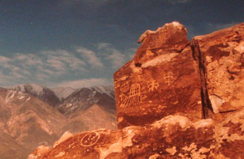
That's nuts! Truely sad. I have some pics of that area about 20 years ago. I will try to find them. |
11/19/2012
Topic:
Camping with your pet
rockhopper
|
Great dogs! We used to camping with my friends dog. Good times! |
11/19/2012
Topic:
Land Cruiser master and slave cylinder replacment
rockhopper
|
Done that repair on my old Datsun Pick up back in the 70's. Drove that thing over 250,000 miles on 3 different engines
BTW Nice new forum format. I can dig it! |
11/21/2012
Topic:
Torote Canyon Loop - Solo Backpacking TR
rockhopper
|
Nice report. Great pictures. Looks like you had a great solo trip. Temps in the 70's and no wind , now that's what I say
is excellent desert hiking / camping weather. You've got me pumped! Looking forward to my next ABSP "expedition" very soon. |
11/21/2012
Topic:
Paiute Petroglyphs Stolen and Defaced
rockhopper
|
I found the pics from the Bishop area from about 25 years ago.
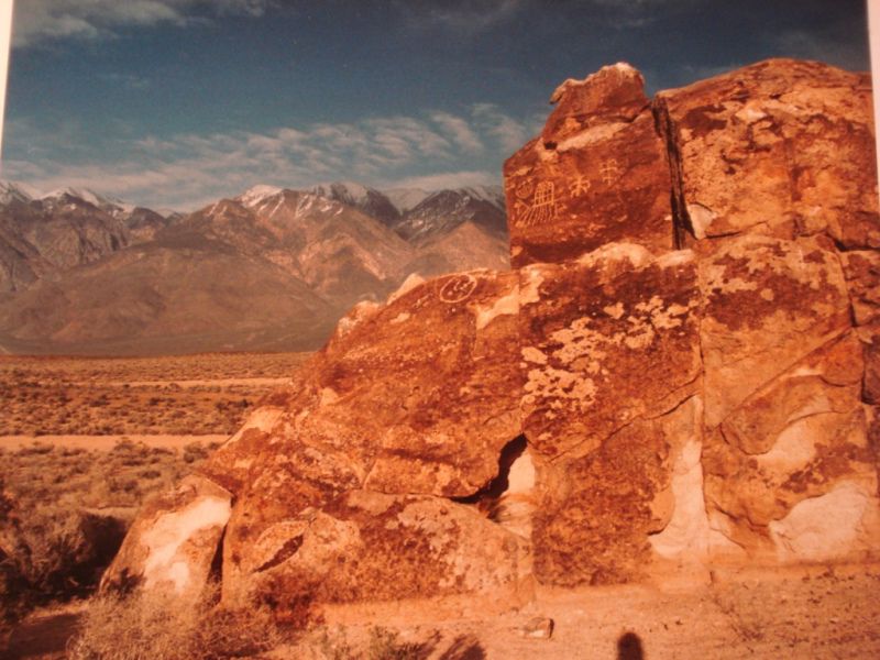
looks like a "chunk" was missing back then.
Is that an alien spacecraft pictograph?
edited by rockhopper on 11/21/2012
edited by rockhopper on 11/21/2012 |
11/28/2012
Topic:
Torote Canyon Video
rockhopper
|
Nice video! I need to learn how to do editing like that.
BTW Nice Lic. plate |
11/30/2012
Topic:
Tropical Storm Kathleen Sept 10, 1976
rockhopper
|
I remember that storm. I was riding a motorcycle back and forth to college in Pomona during that time
I have a feeling that Myer creek will flow thru town again! |
12/1/2012
Topic:
Peg Leg Smith Lost Gold
rockhopper
|
Thanks for sharing. I've read many stories and talked to many Gents over the years regarding Colorado desert Black Gold. Even to the point of metal detecting on several outings outside the ABDSP. I have a pile of "hot rocks" ( highly mineralized rocks that made my detector "sing") sitting in my garage but no large gold nuggets.
The only Gold found in S.D. or Imperial counties was small amounts of Gold dust in Coleman creek in a sluice box and panning. A buddy of mine and myself spent the whole day moving boulders down in the creek and basically wearing ourselfs out. While we were finally panning out our days work, a family of four comes hiking up the creek on a day hike.
"Look daddy , gold miners" LOL. Well, we had just cleaned out the black sand and we had a small ribbon of gold dust
maybe a gram in the bottom of our gold pan. They oooh'd and aaah'd and talking like we struck it rich and quickly hiked off talking amonst themselfs before we could explain our efforts
edited by rockhopper on 12/1/2012
edited by rockhopper on 12/1/2012 |
12/7/2012
Topic:
Vallecito Valley 3 Day Backpack Trip
rockhopper
|
Wow! Super photos! Sounds like an awesome trip. Those arrow tips must have been for hunting rabbits and fowl.
The climate was wetter and greener 100's to 1000 of years ago and more food must have been present to support
the vast desert tribes. When ancient Lake Cahauilla was present to the east it must have been fantastic.
The desert is calling. Need to get off G. Earth and hit the road! |
12/11/2012
Topic:
First Trips To Baja
rockhopper
|
We used to go down to Bahia de Los Angeles every year during the 80's and 90's. Good times!
Thanks for sharing. I've got some old photos around herer somewhere |
12/12/2012
Topic:
What are you reading?
rockhopper
|
Thanks for the suggestions.
Heres a short one I liked
http://angeles.sierraclub.org/dps/archives/dps00752.htm |
12/14/2012
Topic:
Live WEB CAMS
rockhopper
|
Saved as favorite
edited by rockhopper on 12/15/2012
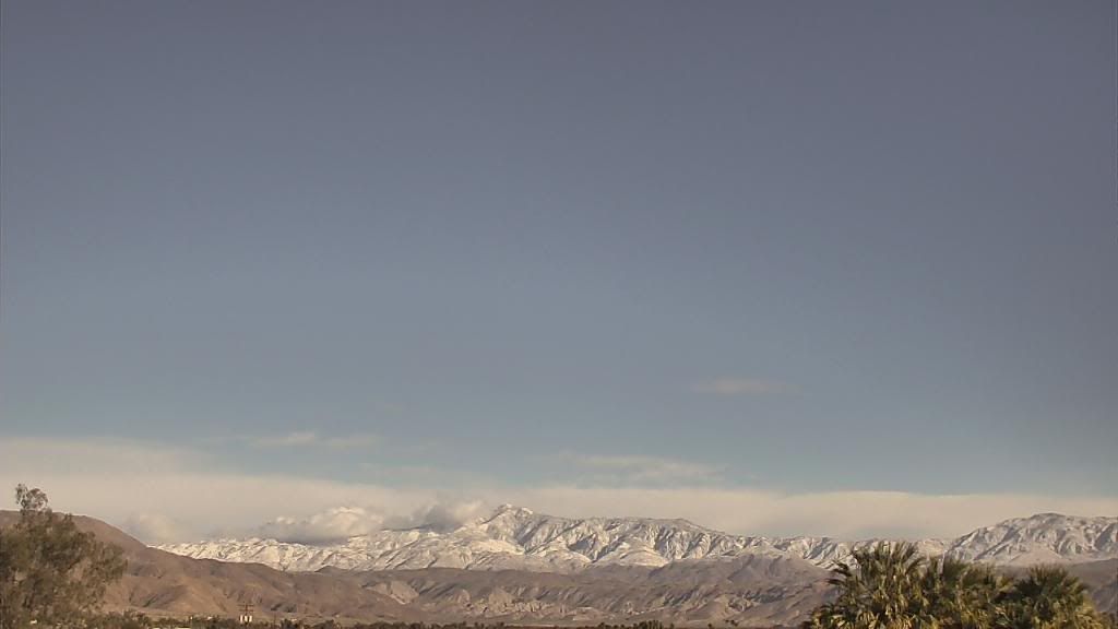
Photos from webcam sat 12-15-12
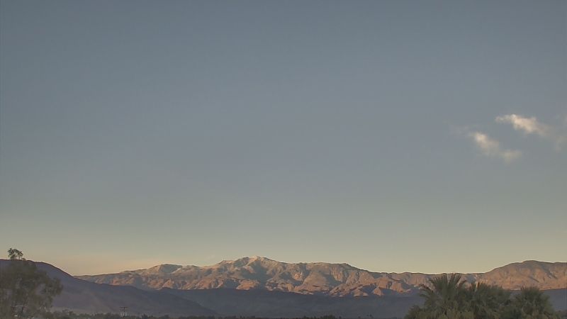
Torro Peak mid day
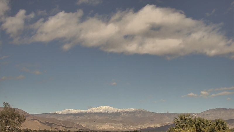
Late afternoon
edited by rockhopper on 12/15/2012
edited by rockhopper on 12/15/2012
edited by rockhopper on 12/15/2012 |
12/14/2012
Topic:
What are you reading?
rockhopper
|
tommy750 wrote:
rockhopper wrote:
Thanks for the suggestions.
Heres a short one I liked
http://angeles.sierraclub.org/dps/archives/dps00752.htm
Wow, that's an impressive trip report. Sounds like a superhuman endeavor. Does this guy have narcolepsy? Not aware of people dropping hypnagogic and hypnopompic into a backpacking story unless they're personally familiar with this sleep disorder. That would make the trek even more impressive! Thanks. Tom
Iknow, The first time I read that I felt "I'm not worthy" Now that is a bust #ss hike!
I had to read it several times for it to sink in |
12/15/2012
Topic:
Lower Harper Canyon and New Tent
rockhopper
|
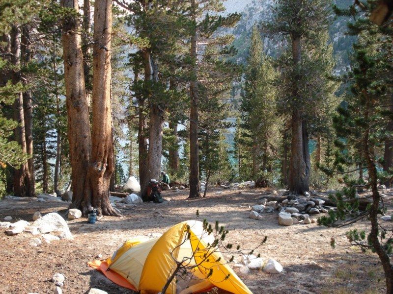
Glad your enjoying your new tent. I went double wide a few life times ago. Bringing back memories of plastic tube tents and the rain in the Sierras with the water rising. Here is my junk, a 30 year old north face tent. My brother in the back ground had epic view spot of the lake. But hey, what are big brothers for! Anyway cheers to the new tent and many more expeditions.
edited by rockhopper on 12/15/2012 |
12/18/2012
Topic:
East Carrizo Canyon and June Wash
rockhopper
|
I still use my old USGS paper maps , sun, moon, stars and compass too |
12/31/2012
Topic:
Gray Mountain
rockhopper
|
I like the B&W pics. Neat old school of days gone by. How big was that sherd? Great eye ball find. |
12/31/2012
Topic:
Nolina Wash
rockhopper
|
Looked like a beautiful day. Last time a well of Eight echos was probably about 25 years ago.
I do remember yelling down it |
12/31/2012
Topic:
First Trips to ABDSP
rockhopper
|
First pic guess is near Whale peak? Looks like you will have to drive all over to match up that pic.
First time for me was around 1965 when my Dad drove us thru the area when I was about 7. |
1/7/2013
Topic:
7 Days in Anza Borrego Desert State Park
rockhopper
|
Looks like an awesome trip! love the fossil paw prints! |
1/7/2013
Topic:
Pinyon Wash to Harper Flat and Cabin
rockhopper
|
I was wondering the same thing. Assesment for what? Water? gold?
Someone here on the forum may chime in on that one.
Neat trip! |
1/7/2013
Topic:
Travertine Palms Oasis and Caves
rockhopper
|
Hello all. Great trips posted so far as desert season is in full gear. Took a two day run out to the desert Fri and Sat the 4th and 5th of January. I'm calling it Expedition 2013.01
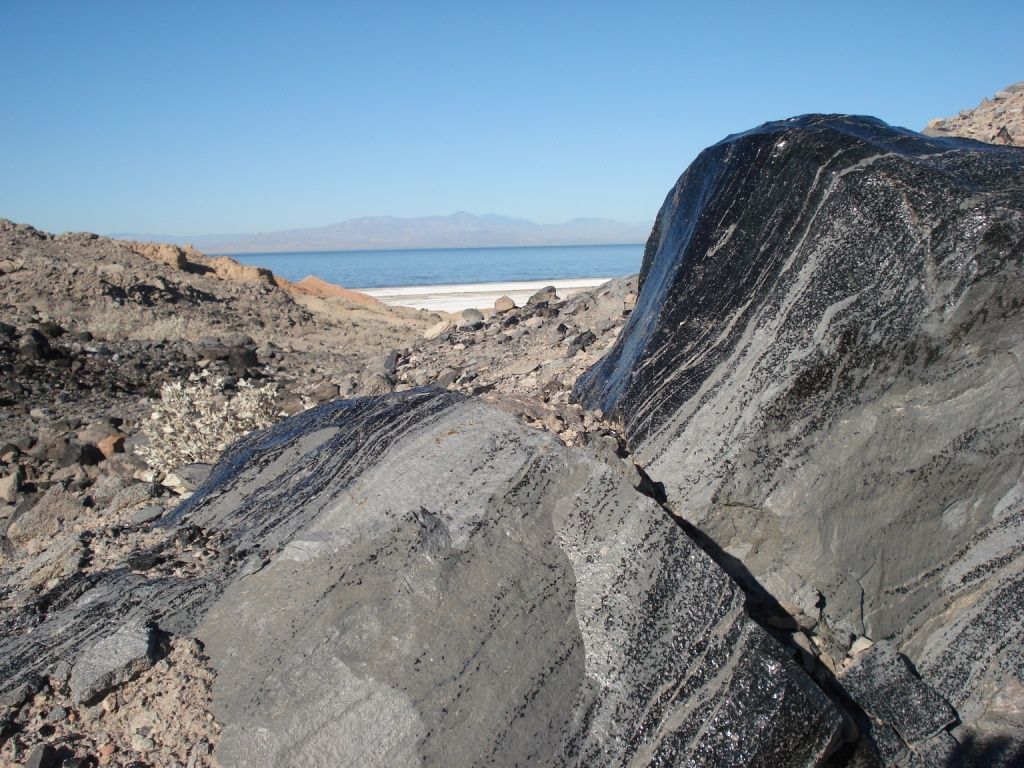
First stop was a quick stop at the geothermal mud volcanoes on the eastern shore of the Salton Sea.
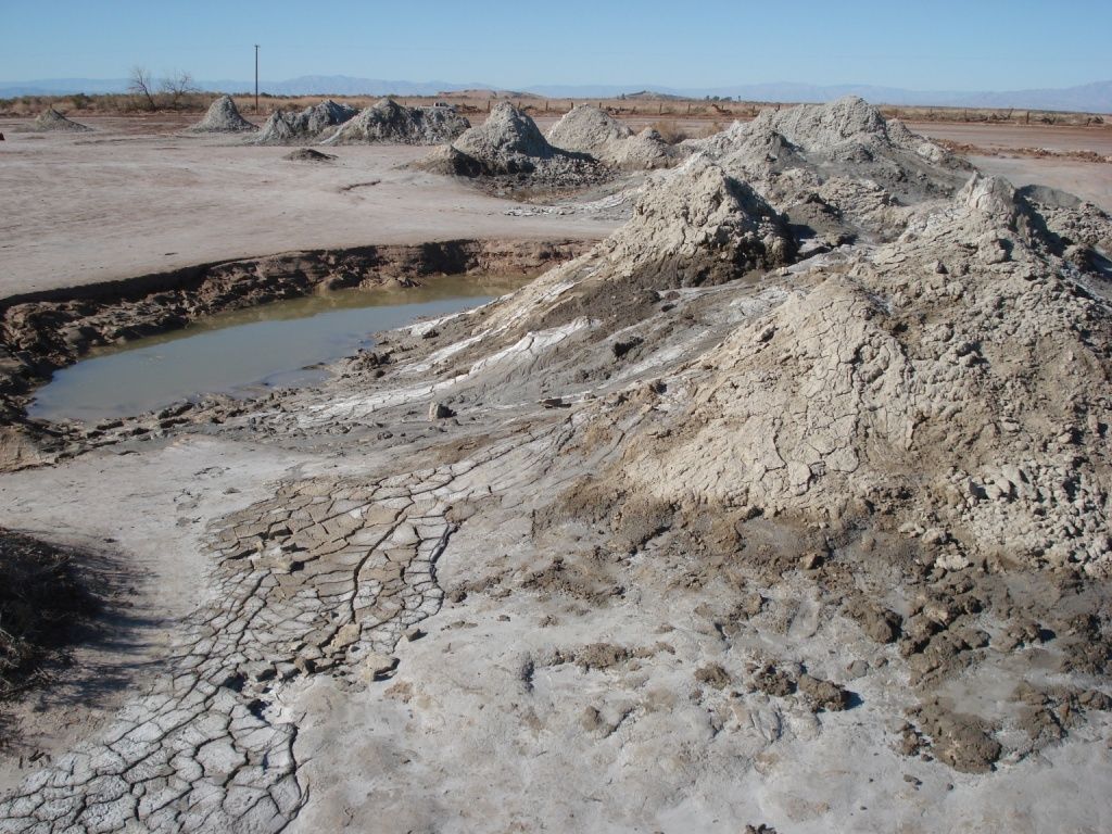
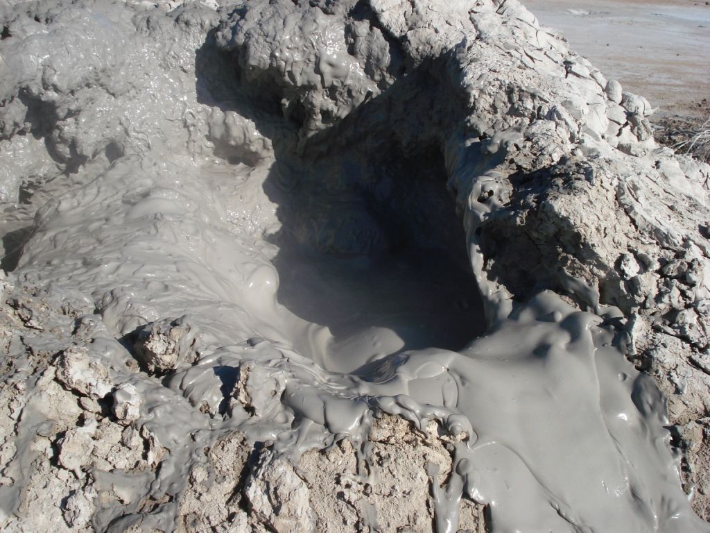
Geothermal plants
Obsidian source with Santa Rosa Mountians in background.
Headed back west to hike on some old Native American trails.
This one is near the old shoreline of Ancient Lake Chauilla
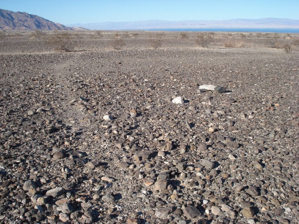
Headed north to the county line. Plan was to hike into ABDSP from the east.
Hit the dreaded lock gate! When ever these #^%&* throw up a new locked barrier could they please proved a turnaround!
Headed back South. Parked and hiked over Mountian passes following the ancient trails to the oasis.
On the off again on again trail. Came over the pass to the right. Ancient shore line kissed these hills on the other side.
Oasis in sight. Villager peak and Rabbit beyond. Can't quite see the peaks.
The "trail"
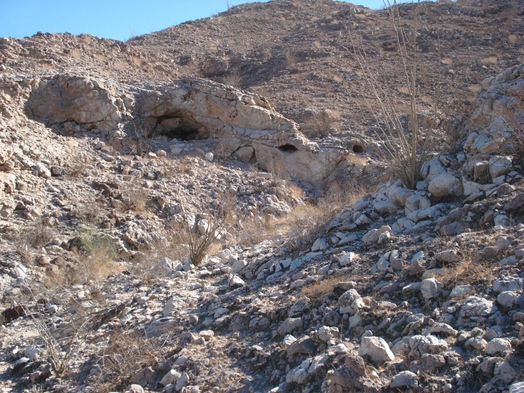
Traverine Palm Oasis
This was an interesting smooth grinding rock.
Area littered with pot shards
Trail marker? with motareo ontop.
more shards
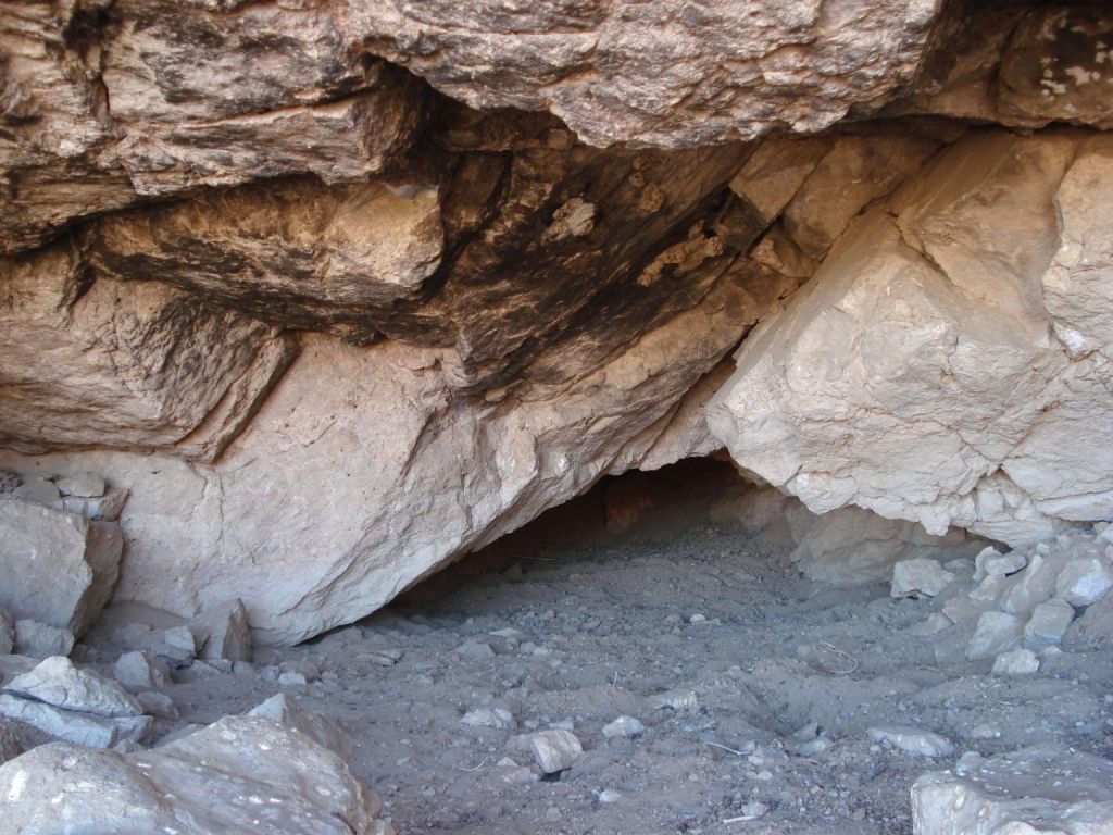
Old trail to Grottos
Arrow point shard
Storm shelter. Looked well used.
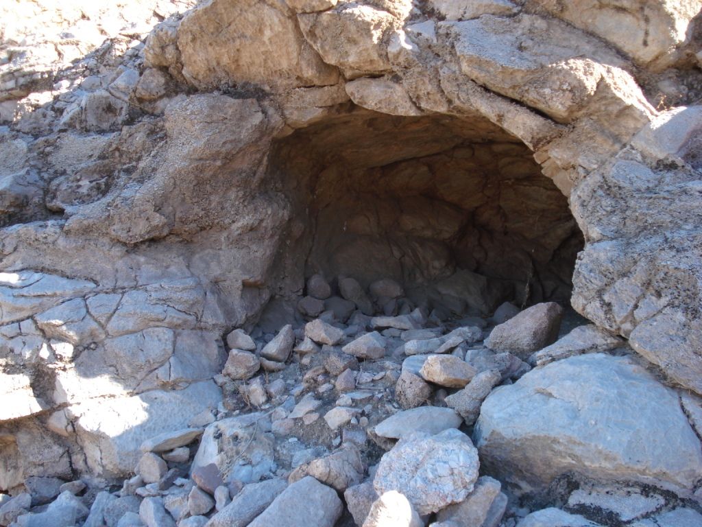
Evidence of cooking and heating. Lots of pottery pieces.
I'll be back!
edited by rockhopper on 1/7/2013
edited by rockhopper on 1/7/2013
edited by rockhopper on 1/8/2013 |
1/8/2013
Topic:
Travertine Palms Oasis and Caves
rockhopper
|
Here are answers to some questions:
Ziphius: There was a walk in excavated well dug near the grove but was dry
Tommy: I have read about the early peoples traveling from far off to these obsidian fields after Lake cahuilla water level dropped down to lower levels as is today.
hikerdmb: I agree the trips of late have been great! Lets keep em' coming!
dsefcik: The photo was taken a few miles north of obsidian butte near the mud pot/ volcanoes.
Red sea? Are you talking about the New River? It looked a little muddy color but no suds.
actually looked better than I would have thought
added a couple youtube videos
Mud Volcanoes
http://www.youtube.com/watch?v=mcQm2-X44Zw
Ancient trail near Ancient Lake Cahuilla shoreline
http://www.youtube.com/watch?v=a9TLMJfGLiE
edited by rockhopper on 1/8/2013 |
1/8/2013
Topic:
7 Days in Anza Borrego Desert State Park
rockhopper
|
Very envious. Beautiful phography. The big horn sheep photos are excellent.
I need to plan a trip into Canebrake. I know that are is HUGE! How does is compare to
like hiking into Rock house canyon the first time?
btw What is the origin of the name Canebrake? Ol' Ranchers name? |
1/14/2013
Topic:
Lower Myer Creek and Old Hwy 80
rockhopper
|
Wonder if there is a connection with Jack Miller? Of Jack Millers cabin in Martinez caynon? Lived in the canyon from 1925 to 1955. It's still there! Although there are alot of Millers. I'm related ( in law) to some. But they are from Colorado
Neat photos, thanks for sharing! |
1/14/2013
Topic:
Travertine Palms Oasis and Caves
rockhopper
|
Added a couple youtube videos of the caves near Travertine Palms
Cave Trail:
http://www.youtube.com/watch?v=kRoxEP78yhw
Caves:
http://www.youtube.com/watch?v=DSqWdbmIriE |
1/27/2013
Topic:
Favorite Photos from 2012
rockhopper
|
Fantastic photos! Tommy's slot canyon pic looks like from an alien planet!
2012 Villager peak hike
Rabbit Peak
Perfect camp spot. Just bring water
Drop off
Just because
edited by rockhopper on 1/27/2013 |
2/7/2013
Topic:
Presidents Day Weekend Backpack Anyone Interested?
rockhopper
|
Dawns peaks sounds awesome. Unfortunately my Wife has us scheduled for yet another wine tasting
bed and breakfast crawl that week in the Santa Inez mountians. I would rather be tent camping in the wilderness.
Have a great trip where ever you end up going. |
2/14/2013
Topic:
Looking For a Ride
rockhopper
|
I "think", repeat I think you might find snow in nooks and crannies above 5000-6000ft. I found a few water caches
along a portion of your route last year, BUT they are for other climbers. If I was desperate, I would leave an I.O.U.Looks like you may get some rain possibly this weekend. I did Villager ( day hike) and Rabbit from the east (day hike) both with carried water. Your route my friend with a 40# back pack is "bust ass" in my rating system, especially from Rabbit to Dawns peak and then downhill to rockhouse valley. I am sure it will be an epic adventure. Good luck.
This may be useful ( I posted before)
http://angeles.sierraclub.org/dps/archives/dps00752.htm |
2/17/2013
Topic:
Daren's Villager Peak Trek
rockhopper
|
Wow! 70# pack! How much water was Daren packing? If it was a dry hike, you ( I )would need about 3 gals. for 4 days and thats about 24 lbs. alone. Good news is that pack gets lighter and lighter as the hike progresses.That trail up Villager peak is one of the best in the county IMHO. Nice steady climb, well marked and outstanding views.
Going from Rabbit to Dawns peak is another story. I am sure Daren will have some great stories.
Bob, good show with helping Daren on his expedition loop trip.
The drop offs on the west side of the trail are awesome.
This is from last Mays Villager peak day hike.
Village peak
edited by rockhopper on 2/17/2013 |
2/19/2013
Topic:
SD mountains to get 18 inches of snow
rockhopper
|
Looks like ABDSP mountian water sources look promising for Feb./ March.
Martinez creek after Feb. rain/snow 1990's

 |
2/25/2013
Topic:
Villager/Rabbit/Dawns Via Mojave & Rockhouse Cyn
rockhopper
|
Daren,
Congratulations on your epic expedition! Going solo climbing thru deer trails, off the steep rocky drop offs with full pack
is truely unique sensation. As about ALIVE as you can be! Good news about the water cache'. I drink alot too!
Did you use 2 hiking poles or just one as in the photo? I can see why you desended on the nose to the right (photo) from the ridge down to RHV. The other one musta looked kinda spikey going down.
Oh yes, I agree on the Google Earth thing. NO WAY does it do justis compared actual boots on the ground. Like, oh yeah, looks like I can cover maybe 1.5 to 2 mi an hour over that ground. NOT!
Again, congrats. Glad you made in back without major spillage or tumbles! |
2/26/2013
Topic:
Villager/Rabbit/Dawns Via Mojave & Rockhouse Cyn
rockhopper
|
Back on the hike thread
Here is my 2012 pic of your first photo taken for a comparo.
All my nice full frame photos got all jacked up in the new and improved photobucket. Arrrrghhhh!
Here's a pic a few days after you came back ( taken off webcam)
now that would have been interesting!
edited by surfponto on 2/27/2013 |
2/27/2013
Topic:
Villager/Rabbit/Dawns Via Mojave & Rockhouse Cyn
rockhopper
|
Surf,
You fixed my photos! How did you do it??. What do I do to fix my "new" photobucket account. I should have left the old account alone! Sorry don't mean to hijack, but photos look soooooo much better. The snow on the Santa Rosas looks way better now!
A big THANKS
rockhopper |
3/1/2013
Topic:
Villager/Rabbit/Dawns Via Mojave & Rockhouse Cyn
rockhopper
|
Thanks,
I think I figured out the new photobuket too. It requires an extra step to post full sized pics.
One more of Villager
edited by rockhopper on 3/1/2013 |
3/4/2013
Topic:
Post your Anza Borrego Sunrise Photo
rockhopper
|
Jan 2013

[IMG]http://i67.photobucket.com/albums/h294/metalmeister/Jan2013097_zpsf159c6cd.jpg[/IMG]
edited by rockhopper on 3/4/2013
edited by rockhopper on 3/4/2013 |
3/6/2013
Topic:
ABDSP is just too vast
rockhopper
|
Holding petrified wood in your hand imaging the entire ABDSP cover in lush forests gets my vote |
3/6/2013
Topic:
Rockhouse Canyon / Dawns Peak
rockhopper
|
Daren,
Good show! Heading back to Dawns peak is awesome. You are probably the only one person to do it twice in the same year! The entire ridge looks like it will get some rain and snow on Friday the 8th. Should be excellent for the wild flower season coming up. I need to head out soon for Expedition 2013-2.0 myself! Getting anxious!
Sorry about your truck. Been there, done that going up Suprise canyon in the Inyos year back. We slid of angled slick bedrock into a big boulder. A storm came in and we were dumped on with snow. We froze, but can laugh about it now |
3/8/2013
Topic:
Rockhouse Canyon / Dawns Peak
rockhopper
|
Daren,
Were is your next trek in the area now you have your "stash" at Dawns peak.
There is a neat old trail from RHC up and over to Martinez canyon. The whole area is just amazing.
The biggest challange is that the trails have been unused since the last use about 150yrs-200yrs? ago
and are over grown as you well know. Now image the ridge trail from Dawns peak to Hwy 74/ Palm canyon
as the same condition as S22 to Villager. Thanks for bashing the trail through |
3/10/2013
Topic:
Temporarily delayed
rockhopper
|
Now I always bring some long (4ft-6ft) plywood strips in my truck bed and a shovel. Don't ask. |
3/11/2013
Topic:
Santa Rosa mountians: Whole lota shaking going on
rockhopper
|
3-11-2013 9:55am 5.2EQ , 9:56am 4.6 & 4.7EQ
http://www.data.scec.org/recent/req2/index.html
http://www.data.scec.org/recent/index.html
edited by rockhopper on 3/11/2013 |
3/28/2013
Topic:
4 Day Backpack in Rockhouse Canyon / Dawns Peak
rockhopper
|
Good show! Dawns peak 3x in a season must be some kind of record. I would love to see the expression of the
remote hiker reading the register lol! Props for bringing the clippers. I used to bring a small folding saw when I used to hike off the PCT down to the ridge lines to explore. Great photos! Thanks for sharing!
edited by rockhopper on 1/19/2014 |
3/30/2013
Topic:
West Mesa and Ancient Lake Cahuilla
rockhopper
|
Here are the fish traps located on the old USGS topo maps taken a few years back.


We had just spent several days up in Martinez canyon and saw this hiking out. Sorry for the shaking camera. He was a mov'n!
edited by rockhopper on 3/30/2013 |
4/4/2013
Topic:
Cedar Creek Falls to Re-Open
rockhopper
|
I've always hiked to the falls from the end of Eagle Creek road. Nice easy hike on the old dirt road down to the SD river valley. Usually in the winter when it's cooler and the kids in school. Still, people always show up later in the day mostly from the Ramona side. When the beer ice chests show up with the jumpers is when we put our boots back on
btw anyone else hike down the SD river from hwy 78? Made it down a few miles over waterfalls, boulders etc. some really neat old camp spots in the oak trees. These were old native american sites. Grind holes and pot sherds tell the story. |
4/9/2013
Topic:
4-8-13 Windstorm
rockhopper
|
Followed ABDSP web cam, went out yesterday while watching HUGE sand storms roll thru.
Also talked with an associate out in Palm springs and said " No golf today" |
4/15/2013
Topic:
Fish Creek Mts and Ancient Lake Cahuilla
rockhopper
|
Fantastic map of 1761. Great trip. Thanks for sharing.Those first rock circles look like fish traps. I love the rounded beach rock photo. Definately a pot drop right there!Those miners were a tough bunch. Looks like they gave up too!
I've traced the ancient shores line(s) on Google Earth and on foot over the years. From articles out there on google searchs the lake has been filling and evaporating for hundreds of thousand of years. Taking about 50 years to go dry. The high water mark has changed over time due to the pull apart basin and tectonic uplfting. It is a very interesting area indeed! Some more photos to add in.


Ancient shore line along the western edge further north. You can see trails and camp sites .
Unfortunately there has been a lot of 4x4 activity near and around these areas, However there are still many areas
you can hike on for hours which are still "pristine" . Many trails end abruptly at an erosion only to continue on beyond:-)

Trail along shore line
Trails above the shore line
One of many caves near shoreline
edited by rockhopper on 4/15/2013
edited by rockhopper on 4/15/2013 |
5/13/2013
Topic:
Rockhouse Canyon / Toro Peak BackPack Trip
rockhopper
|
Great trip. Climbing El Torro from the south side! I've always thought that would be a great trip.
Tons of areas to explore and seldom visited but has history. Again gret trip and super photos.
Thanks for sharing~! |
5/18/2013
Topic:
Siemens Shuts Down Wind Turbines after accident
rockhopper
|
Those are some Huge Blades! Can't imagine a failure unless some one flubbed up. Will be interesting to see the outcome. I assume they come as a pre-balanced package. How you you like to balance one of those puppies on site.
Oh yes, When it's 110 deg outside. |
6/23/2013
Topic:
Any Home Brewers out there?
rockhopper
|
Not me, but a good friend in Linda Vista brewed some fantastic beers. He won several medals at the Del Mar Fair, I guess it's called the county fair now?! Anyway, he had years and years of practice and it was awesome . He used to park early down at Mission beach in the summer and open the side door to a nearly full kegger of His beer! Having a few watching the roller skate babes go by.
Good show! Bring some of your beer out for a desert adventure.
I Have friends living on Kaui since the 70's. My Father in law is over on Oahu. Good times
My fav beers are probably Stone and Long Board but NOTHING beats a draft beer poured in a 400 year old pub in Wales or London |
7/9/2013
Topic:
Chariot Fire
rockhopper
|
Mt Langley. Way to go! That was my first 14,000 ft peak I climbed years back. I found a real cool multi quartz crystal on the way up. Looking across at Whitney was so cool!
Been ubber HOT in ABDSP! I have friends who sold their house in Mission beach and bought a house in Borrego Springs.
Will visit them in the fall. Hanging close to the coast or up in the mountians till then.
Chariot canyon is HUGE. Which part? the North towards the gate or towards oriFLAME canyon?
Almost bought a cabin back in the 90's overlooking Chariot canyon. View to the Salton Sea mud pots. Wonder if she is in the line of fire? |
7/18/2013
Topic:
Mountian Center Fire
rockhopper
|
Hope they can contain it. This thing is an inferno. I am seeing it driving east every morning to help my Dad.That area has not burned this big since I came to California in 1962. Areas along the PCT have some "Old growth pockets" of cedar 300+ years?? old. I hope that Cedar springs is spared. That has been a favorite spot for generations of back country folks. The section of the PCT along the ridge line from hwy 74 to San Jac. is one of the many highlight sections of the trail. The only positives I can say are forest re-generation, kill those damn tree beetles and excellent X-country hiking after the winter rains. |
8/26/2013
Topic:
Flash Flood Chasing
rockhopper
|
Local news shows S22 closed. 1"-2" in Borrego area today
edited by rockhopper on 8/26/2013 |
9/3/2013
Topic:
Mountian Center Fire
rockhopper
|
Looks like Fobes ranch got hammered. Too Bad. Looks like the old growth Cedar forest around Cedar springs may have been spared?? I sure hope so. That place is just awesome. I am heading in to check out the PCT after the Winter rains closed signs or not. |
9/3/2013
Topic:
How many straws are drinking from the Colorado?
rockhopper
|
Someday. Someday the Colorado or the Sea of Cortez will fill the Salton sink to sea level. Probably due to Flooding from the other side climate change or massive earthquakes. Someday... |
9/19/2013
Topic:
Quick Trip to Borrego Springs - 9/14-15/2013
rockhopper
|
Great soil. All it needs is water. (-.' |
9/19/2013
Topic:
Golden Trout Wilderness
rockhopper
|
The Kern Basin should be near the top of the list. One September before cell phones, we were three days in. Beautiful sunny 60's Deg. Next day started to rain, then snow.................!!! It was a loop trip and were basicly half way out. Going forward we used our compass with topo. Long 12 hour hike out. The snow never stopped, 12,000 pass, turned to rain as we finally made it down in elevation to the parking lot.
Ya, sorry to hear about your truck. I like what you said about "immature technologies" !The Designers and assemblers
can't keep up with the legislation of regulation.
We just got back. Sept. 9th-17th from up in the NorCal Redwoods.
edited by rockhopper on 9/19/2013
edited by rockhopper on 9/19/2013 |
9/19/2013
Topic:
Golden Trout Wilderness
rockhopper
|
Cross country in the Sierras is a hoot. After a few seasons we finally realized all the good hikes were right at the edge of timber line or above. Summers Sierra, Winters Desert!
Good luck with the truck. I just put 1765 miles on my Redwoods / Calastoga / Vichy Hot springs road trip |
9/22/2013
Topic:
Forum Member Nolan in Truck Camper Magazine
rockhopper
|
Telescope peak is a great hike on a clear day. I'll scan some photos someday
Most canyons have roads/ trails to the old mining camps, and there are tons of them.
We spent weeks in the Panamints and Death Valley ranges years back. There are SO many stories
of the 49'r crossings, native attacks, lost Gold, etc...etc..
BE Careful of mine shafts, they are Everywhere! Asbestos, Lead, Silver, mines Abandoned Explosives, etc..., we blew up later...My friends dog fell down a mine shaft while inside a horizontail mine about 1/4 mile in. |
10/1/2013
Topic:
All National Parks Shutdown
rockhopper
|
Add in to the mix.....
http://earthquake.usgs.gov/earthquakes/map/#%7B%22feed%22%3A%221day_m25%22%2C%22search%22%3Anull%2C%22sort%22%3A%22newest%22%2C%22basemap%22%3A%22grayscale%22%2C%22autoUpdate%22%3Atrue%2C%22restrictListToMap%22%3Atrue%2C%22timeZone%22%3A%22local%22%2C%22mapposition%22%3Anull%2C%22overlays%22%3A%7B%22plates%22%3Atrue%7D%2C%22viewModes%22%3A%7B%22map%22%3Afalse%2C%22list%22%3Atrue%2C%22settings%22%3Afalse%2C%22help%22%3Afalse%7D%7D |
10/10/2013
Topic:
All National Parks Shutdown
rockhopper
|
One thing I observed during my years of traveling in other countries is how people react to governmental laws and regulations. If its a dumb law or stupid regulation THEY IGNORE IT! Even the local police know its a stupid law and don't bother enforcing because of the local backlash would erupt.
Back here in the USA we've done it to ourselves. Most have totaly wimped out and obey all commands sent down from above. There are thousands of new laws and regulations enacted in the US every year.
If I drove hours out to backpack for a few days or week and there is a sign "No Entry" to thousands of square miles of wilderness. I know what I would do. |
10/12/2013
Topic:
Davies Valley To BM Kirk
rockhopper
|
Looking at those SUV's reminds me of the movie "No Country for Old Men" Wonder what the story was?
Looks like a great trip. I am heading out to the mud volcanos and hot springs soon now that the temps are dropping. |
11/11/2013
Topic:
Memorials in the Park
rockhopper
|
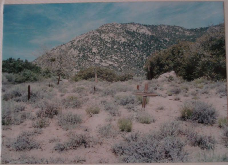
Unknown graves on the West side of Toro Peak , South West of the old lumber mill at elevation approx. 6500 ft.
Anyone have any info?
edited by rockhopper on 11/11/2013
edited by rockhopper on 11/11/2013 |